
Image: Mao Kun map - Singapore
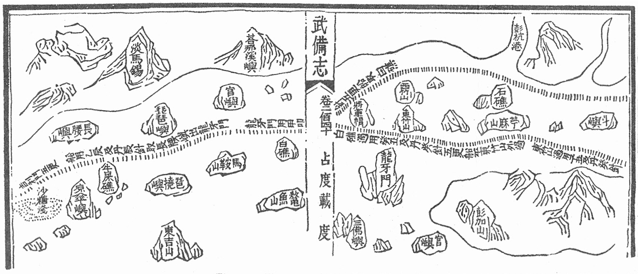
Description: A Mao Kun map showing Singapore and part of the east coast of the Malay peninsula. Temasek (early Singapore; "淡馬錫) is marked at the top left corner, others identified by Wheatley are Pulau Brani (琵琶嶼), Blakang Mati (長腰嶼, Sentosa), Pedra Branca (白礁), Pulau Tinggi (將軍帽), Pulau Aur (東竹山 and 西竹山), Pahang River estuary (彭杭港), and Pulau Tioman (苧麻山). Long Ya Men (龍牙門) on the map is said to mark the entrance to Keppel Harbour. Note that different sources may identify the islands differently, especially the islands of Singapore. J. V. G. Mills for example identified 長腰嶼 as Pulau Satumu and 琵琶嶼 as Pulau Sakijang Pelepah.
Title: Mao Kun map - Singapore
Credit: Scanned from Paul Wheatley (1961) The Golden Khersonese: Studies in the Historical Geography of the Malay Peninsula before A.D. 1500, Kuala Lumpur: University of Malaya Press OCLC: 504030596. Originally from the Wubei Zhi (Treatise on Armament Technology), a 17th century work with maps based on material dated to the voyages of Zheng He (early 15th century).
Author: Mao Yuanyi (1594–1640?), editor of the Wubei Zhi; and an unknown cartographer.
Usage Terms: Public domain
License: Public domain
Attribution Required?: No
Image usage
The following page links to this image:
