
Image: Map-of-tennassee-government-1796

Size of this preview: 800 × 381 pixels. Other resolutions: 320 × 152 pixels | 2,794 × 1,330 pixels.
Original image (2,794 × 1,330 pixels, file size: 353 KB, MIME type: image/jpeg)
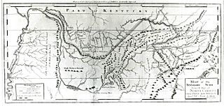
Description: "Map of the Tennassee Government," an early map of the U.S. state of Tennessee
Title: Map-of-tennassee-government-1796
Credit: TN4Me.org
Author: Daniel Smith (1748–1818)
Usage Terms: Public domain
License: Public domain
Attribution Required?: No
Image usage
The following 2 pages link to this image:

All content from Kiddle encyclopedia articles (including the article images and facts) can be freely used under Attribution-ShareAlike license, unless stated otherwise.