
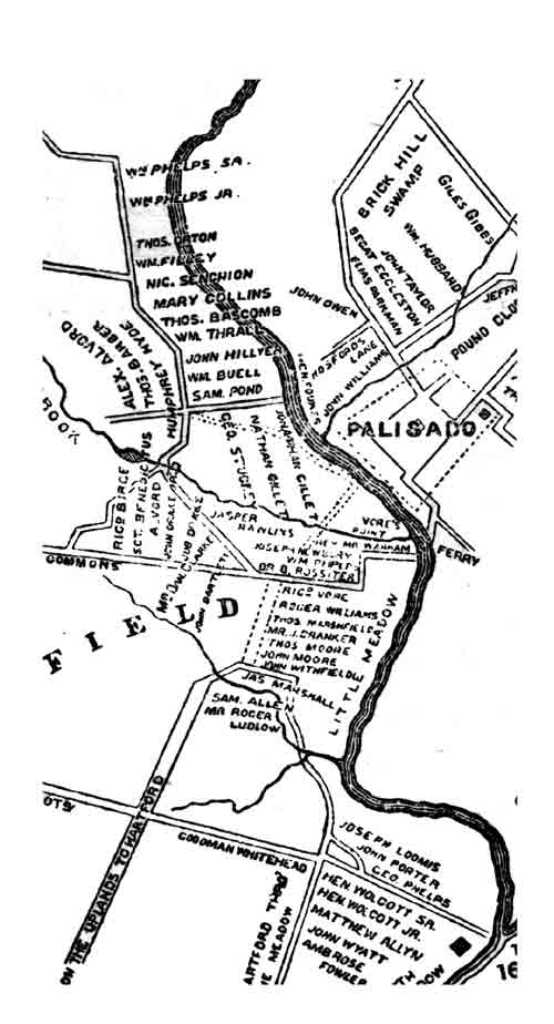
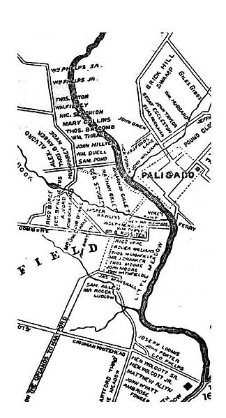
Image: Map-windsor-closeup-1654
Size of this preview: 324 × 599 pixels. Other resolutions: 130 × 240 pixels | 500 × 924 pixels.
Original image (500 × 924 pixels, file size: 44 KB, MIME type: image/jpeg)
Description: Enlarged portion of map of Windsor, Connecticut 1640-1654 showing area around the Palisade or fort.
Title: Map-windsor-closeup-1654
Credit: The Phelps Family of America and Their English Ancestors, two volumes. Eagle Publishing Company of Pittsfield, Massacusetts.
Author: Oliver Seymour Phelps and Andrew T. Servin.
Usage Terms: Public domain
License: Public domain
Attribution Required?: No
Image usage
The following page links to this image:

All content from Kiddle encyclopedia articles (including the article images and facts) can be freely used under Attribution-ShareAlike license, unless stated otherwise.