
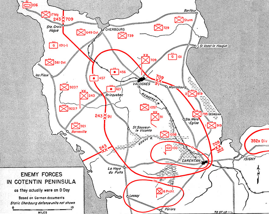
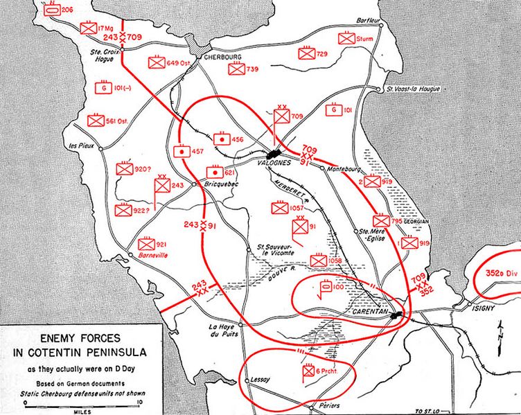
Image: Map10
Size of this preview: 752 × 599 pixels. Other resolutions: 301 × 240 pixels | 882 × 703 pixels.
Original image (882 × 703 pixels, file size: 216 KB, MIME type: image/jpeg)
Description: Map of German positions on Cotentin Peninsula, D-Day, 6 June 1944
Title: Map10
Credit: Utah Beach to Cherbourg (6 June-27 June 1944). Washington, Historical Division, Department of the Army, 1947. Immediate source: www.history.army.mil, Map 10
Author: Historical Division, Department of the Army
Usage Terms: Public domain
License: Public domain
Attribution Required?: No
Image usage
The following page links to this image:

All content from Kiddle encyclopedia articles (including the article images and facts) can be freely used under Attribution-ShareAlike license, unless stated otherwise.