
Image: MapNewtown1852LargeDetail-NYPLfromRiker
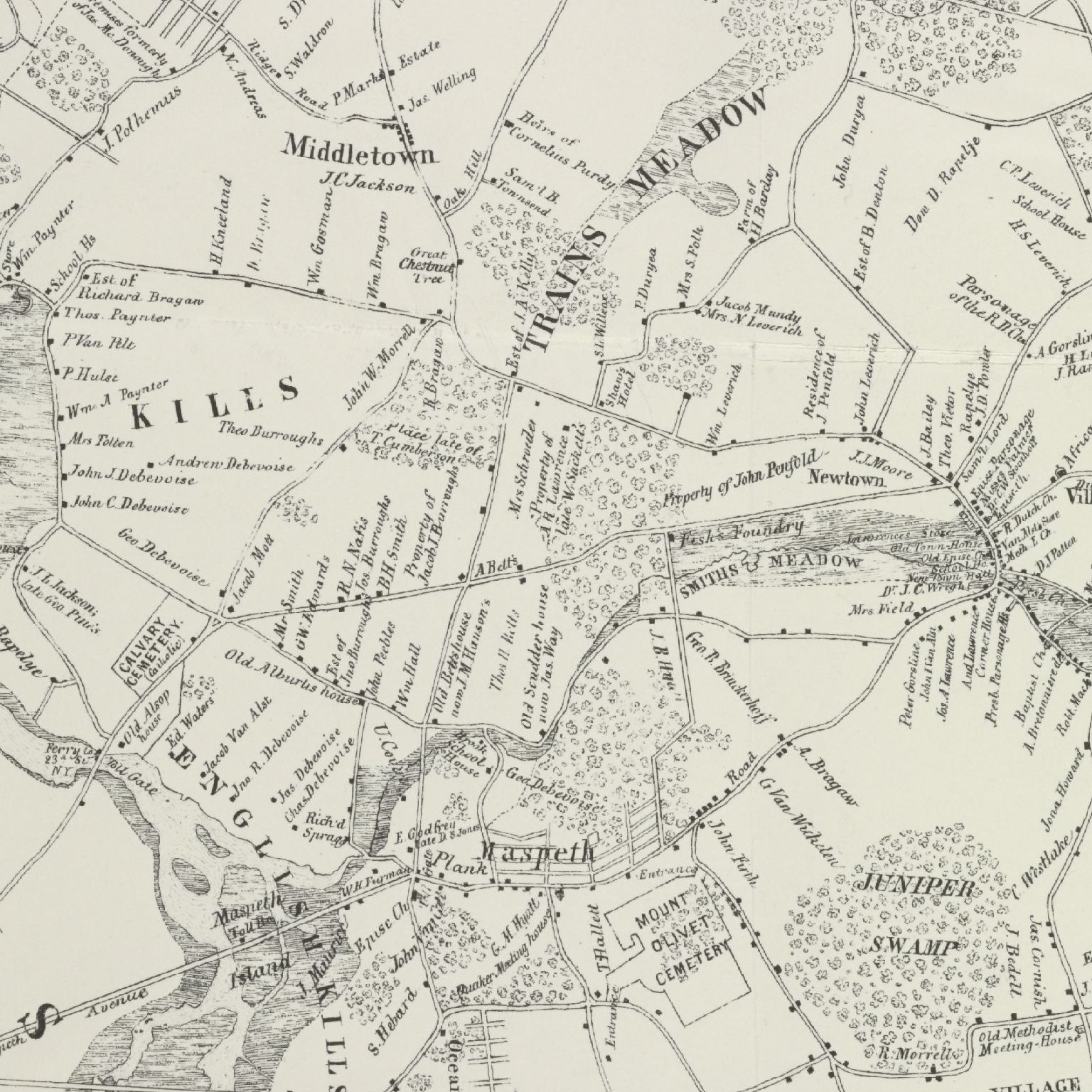
Description: This is a detail from "Map of Newtown, Long Island. Designed to exhibit the localities referred to in the 'Annals of Newtown.' Compiled by J. Riker, Jr. 1852." It shows the area that would become Woodside, bounded in the west by Middletown and Dutch Kills (shown as "Kills" in the detail), in the south by English Kills and Maspeth, and in the east by the Village of Newtown (shown as "Vill" in the detail). Woodside's northern boundary is approximately the top border of the map. The "Great Chestnut Tree" was actually located on the west side of the road where it is shown.
Title: MapNewtown1852LargeDetail-NYPLfromRiker
Credit: The annals of Newtown, in Queens County, New York; containing its history from its first settlement, together with many interesting facts concerning the adjacent towns (New-York, D. Fanshaw, 1852) James Riker, Jr.
Author: James Riker, Jr.
Usage Terms: Public domain
License: Public domain
Attribution Required?: No
Image usage
The following 2 pages link to this image:
