
Image: MapThirdYpresFrezenbergSeptemberOctober1917
No higher resolution available.
MapThirdYpresFrezenbergSeptemberOctober1917.jpg (800 × 577 pixels, file size: 158 KB, MIME type: image/jpeg)
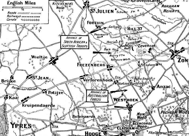
Description: Map of roads, towns and topography of area N-E of Ypres, centred on Frezenberg area, showing the Allied advances of September-October 1917 during the Third Battle of Ypres.
Title: MapThirdYpresFrezenbergSeptemberOctober1917
Credit: Based on map in "The Great War" Volume 10, edited by H W Wilson, published 1918.
Author: not stated. Published in "The Great War" Volume 10, edited by H W Wilson, published 1918.
Usage Terms: Public domain
License: Public domain
Attribution Required?: No
Image usage
The following 2 pages link to this image:

All content from Kiddle encyclopedia articles (including the article images and facts) can be freely used under Attribution-ShareAlike license, unless stated otherwise.