
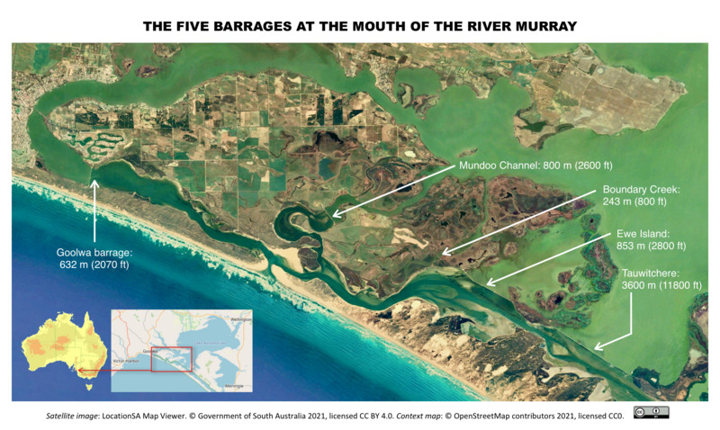
Image: Map -- location of barrages at the mouth of the River Murray
Size of this JPG preview of this TIF file: 800 × 478 pixels. Other resolution: 320 × 191 pixels.
Original image (2,338 × 1,396 pixels, file size: 12.45 MB, MIME type: image/tiff)
Description: Satellite image map showing the barrages at the mouth of the River Murray, South Australia
Author: Government of South Australia (Location SA Map Viewer)
Usage Terms: Creative Commons Attribution-Share Alike 3.0
License: CC-BY-SA-3.0
License Link: http://creativecommons.org/licenses/by-sa/3.0/
Attribution Required?: Yes
Image usage
The following page links to this image:

All content from Kiddle encyclopedia articles (including the article images and facts) can be freely used under Attribution-ShareAlike license, unless stated otherwise.