
Image: Map Monschau Habscheid

Size of this preview: 558 × 600 pixels. Other resolutions: 223 × 240 pixels | 651 × 700 pixels.
Original image (651 × 700 pixels, file size: 144 KB, MIME type: image/jpeg)
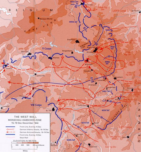
Description: Map of the Ardennes depicting the West Wall, Monschau Habscheid zone, 15 to 19 December, 1944, St. Vith area, Battle of the Bulge
Title: Map Monschau Habscheid
Credit: Department of Defense, Center of Military History, United States Army
Author: http://www.history.army.mil/brochures/ardennes/aral.htm Ardennes-Alsace, The U.S. Army Campaigns of World War II
Usage Terms: Public domain
License: Public domain
Attribution Required?: No
Image usage
The following page links to this image:

All content from Kiddle encyclopedia articles (including the article images and facts) can be freely used under Attribution-ShareAlike license, unless stated otherwise.