
Image: Map North America 1540 Strait of Anian
No higher resolution available.
Map_North_America_1540_Strait_of_Anian.png (767 × 523 pixels, file size: 236 KB, MIME type: image/png)
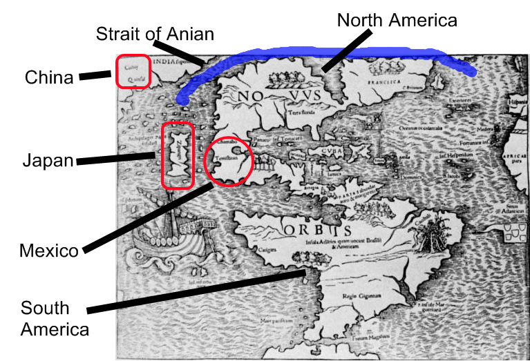
Description: Map of North America, Asia and Europe first published in 1540, showing Strait of Anian or Northwest Passage
Title: Map North America 1540 Strait of Anian
Credit: base map is PD (image older than 1540 and author dead); additional work by author
Author: NorCalHistory
Usage Terms: Creative Commons Attribution-Share Alike 3.0
License: CC-BY-SA-3.0
License Link: http://creativecommons.org/licenses/by-sa/3.0/
Attribution Required?: Yes
Image usage
The following page links to this image:

All content from Kiddle encyclopedia articles (including the article images and facts) can be freely used under Attribution-ShareAlike license, unless stated otherwise.