
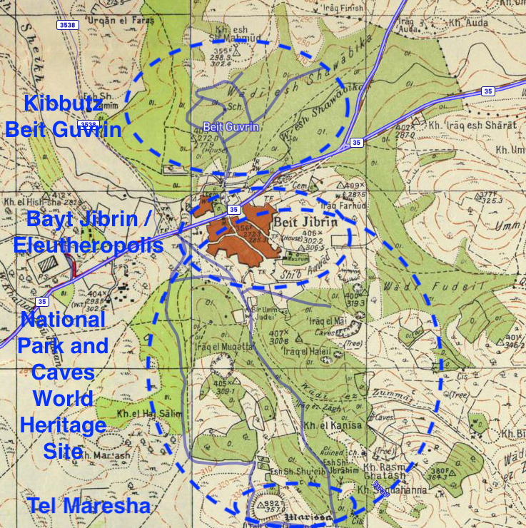
Image: Map illustrating the locations of Kibbutz Beit Guvrin, historical Bayt Jibrin-Eleutheropolis, the ancient caves World Heritage Site, and Tel Maresha (1940s Survey of Palestine map with modern overlay)
Size of this preview: 597 × 599 pixels. Other resolutions: 239 × 240 pixels | 737 × 740 pixels.
Original image (737 × 740 pixels, file size: 393 KB, MIME type: image/jpeg)
Description: Map illustrating the locations of Kibbutz Beit Guvrin, historical Bayt Jibrin-Eleutheropolis, the ancient caves World Heritage Site, and Tel Maresha (1940s Survey of Palestine map with modern overlay)
Title: Map illustrating the locations of Kibbutz Beit Guvrin, historical Bayt Jibrin-Eleutheropolis, the ancient caves World Heritage Site, and Tel Maresha (1940s Survey of Palestine map with modern overlay)
Credit: File:Historical map series for the area of Bayt Jibrin (1940s with modern overlay).jpg With overlaid text
Author: File:Historical map series for the area of Bayt Jibrin (1940s with modern overlay).jpg
Usage Terms: Public domain
License: Public domain
Attribution Required?: No
Image usage
The following page links to this image:

All content from Kiddle encyclopedia articles (including the article images and facts) can be freely used under Attribution-ShareAlike license, unless stated otherwise.
.jpg)