
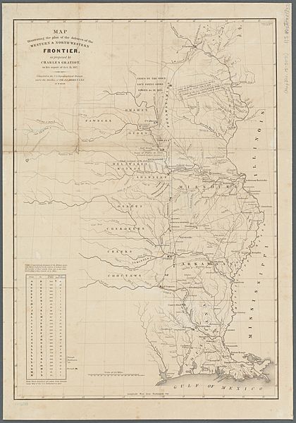
Image: Map illustrating the plan of the defences of the western & north-western frontier (NYPL b20643878-5437624)

Description: * Shows rivers, roads, Indian lands, forts, military posts, cities and settlements, from the Mississippi River to the Great Plains and south to the Gulf of Mexico. Prime meridian: Washington. Longitude coordinates expressed here as measured from Greenwich. Includes distance table. In upper right corner of map: 2 Session, 25 Congress, S. no. 2, Doc. 65. Scale approximately 1:3,600,000 (W 103°--W 89°/N 46°--N 29°) Mapping the Nation (NEH grant, 2015-2018)
Title: Map illustrating the plan of the defences of the western & north-western frontier (NYPL b20643878-5437624)
Credit: https://digitalcollections.nypl.org/items/a3b51bf0-3226-0133-ba97-58d385a7b928
Author: Scan by NYPL
Permission: This image is available from the New York Public Library's Digital Library under the digital ID 99737c20-3225-0133-f206-58d385a7b928: digitalgallery.nypl.org → digitalcollections.nypl.org
Usage Terms: Public domain
License: Public domain
Attribution Required?: No
Image usage
The following page links to this image:

.jpg)