
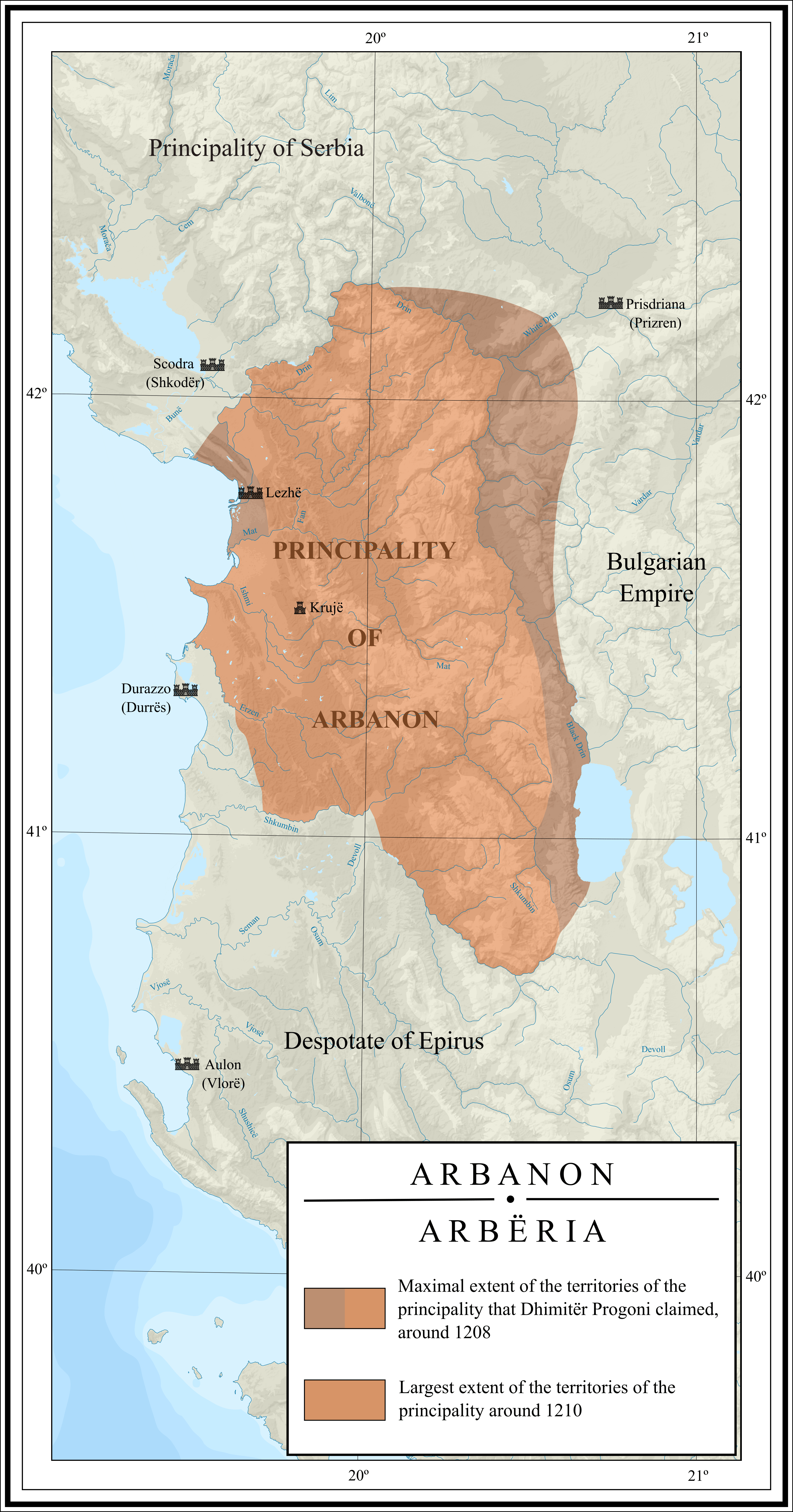
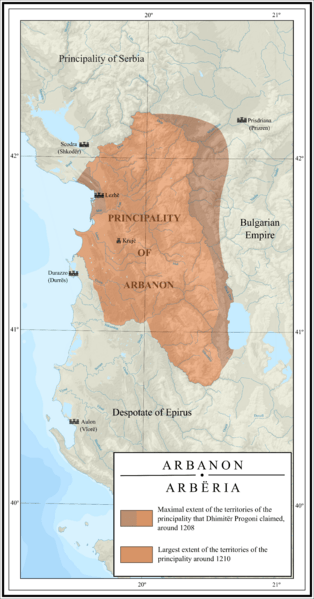
Image: Map of Arbanon (Arbëria)
Description: Map depicting the largest extent of the Principality of Arbanon during its phase of autonomy in the beginning of the 13th century. The map also depicts the territories in the region that Dhimitër Progoni claimed to control.
Title: Map of Arbanon (Arbëria)
Credit: Own work, based on following sources: Frashëri, Kristo (2008) Historia e qytetërimit shqiptar: nga kohet e lashta deri ne fund të Luftës së Dytë Botërore, Academy of Sciences of Albania, p. 73 ISBN: 9789995610135. Haluščynskyj, Theodosius Titus (1954) Acta Innocentii PP. 3: 1198-1216, Typis Polyglottis Vaticanis, p. 338 . Topography taken from the vectorial map of Albania, made by PZmaps. File:Albania_map-en.svg
Author: Ahmet Q.
Usage Terms: Creative Commons Attribution-Share Alike 4.0
License: CC BY-SA 4.0
License Link: https://creativecommons.org/licenses/by-sa/4.0
Attribution Required?: Yes
Image usage
The following 2 pages link to this image:

.png)