
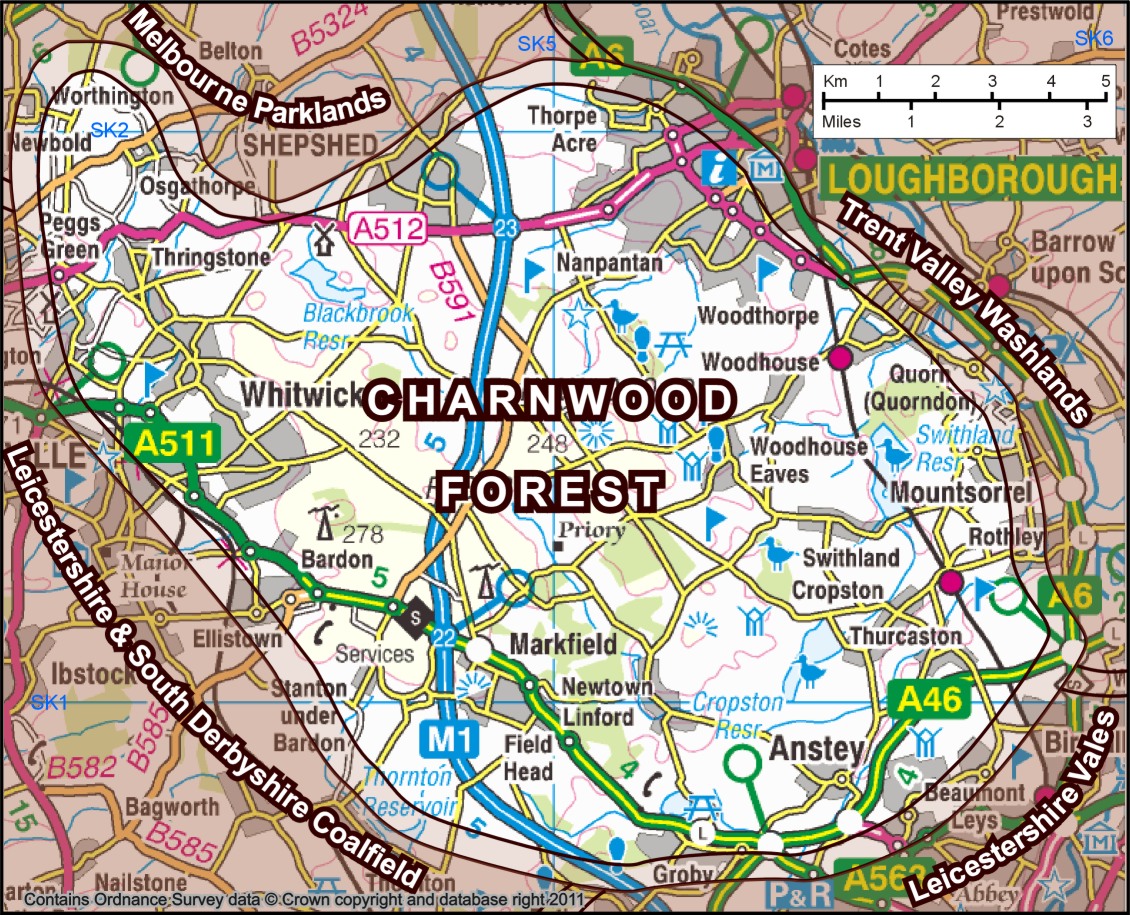
Image: Map of Charnwood Forest NCA73 area
Description: Map of Charnwood Forest, an area of hills and crags in the English East Midlands. Base map from OS 1:250 000 opendata map, overlaid with the Charnwood Forest boundary defined by Natural England's National Character Area 73. The double line indicates that landscapes do not have an abrupt boundary, but the width is purely diagramatic.
Title: Map of Charnwood Forest NCA73 area
Credit: created by Robin Stevenson based on Ordnance Survey data © Crown copyright and database right 2011 available under OS Opendata, from OS 1:250 000 Scale Colour Raster map SK, downloadable from https://www.ordnancesurvey.co.uk/opendatadownload/products.html with Character Area information from Natural England http://www.naturalengland.org.uk/ourwork/landscape/englands/character/areas/charnwood.aspx
Author: Robin Stevenson based on Ordnance Survey data © Crown copyright and database right 2011 under UK Open Government licence at http://www.nationalarchives.gov.uk/doc/open-government-licence/open-government-licence.htm
Usage Terms: Ordnance Survey OpenData Licence
License: OS OpenData
License Link: https://www.ordnancesurvey.co.uk/business-and-government/licensing/using-creating-data-with-os-products/os-opendata.html
Attribution Required?: Yes
Image usage
The following page links to this image:
