
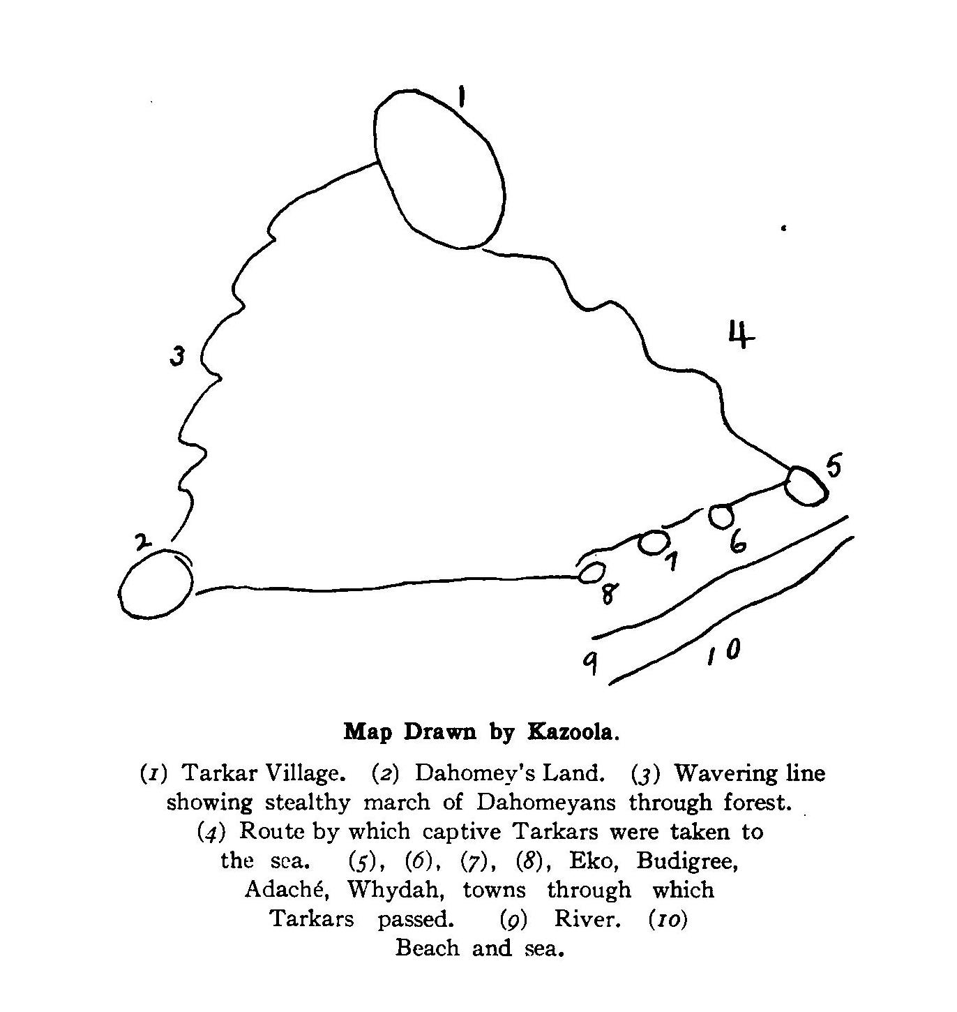
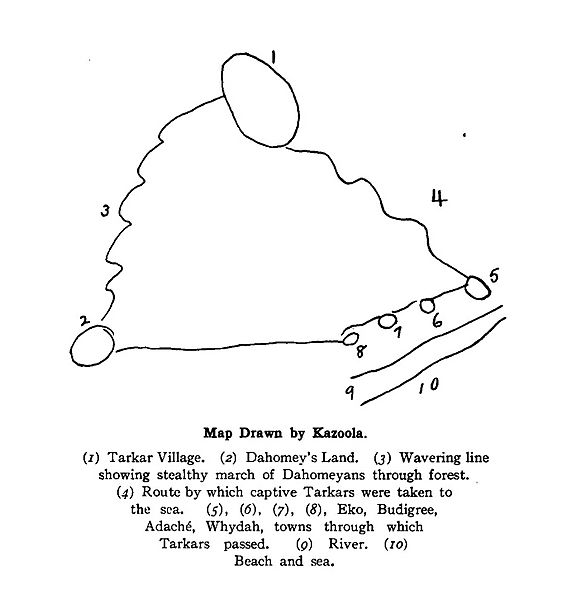
Image: Map of Cudjo Lewis' Capture in Africa
Size of this preview: 567 × 599 pixels. Other resolutions: 227 × 240 pixels | 1,372 × 1,450 pixels.
Original image (1,372 × 1,450 pixels, file size: 132 KB, MIME type: image/jpeg)
Description: Map drawn by Cudjo Kossola Lewis, last surviving victim of the Atlantic slave trade between Africa and the United States, showing the path of his capture and enslavement in West Africa.
Title: Map of Cudjo Lewis' Capture in Africa
Credit: Historic Sketches of the South (New York, Knickerbocker Press, 1914), pp. 88-89
Author: Cudjoe Lewis (Kazoola)
Usage Terms: Public domain
License: Public domain
Attribution Required?: No
Image usage
The following page links to this image:

All content from Kiddle encyclopedia articles (including the article images and facts) can be freely used under Attribution-ShareAlike license, unless stated otherwise.