
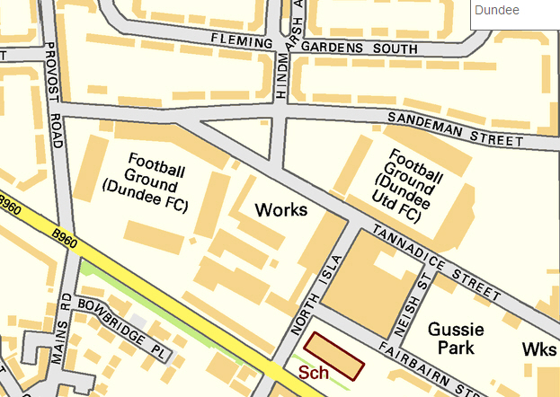
Image: Map of Dens Park and Tannadice Park, Dundee, Scotland, October 2010
No higher resolution available.
Map_of_Dens_Park_and_Tannadice_Park,_Dundee,_Scotland,_October_2010.jpg (623 × 442 pixels, file size: 249 KB, MIME type: image/jpeg)
Description: A street map showing the proximity of Dundee F.C.'s home ground Dens Park (left), to Dundee United F.C.'s home ground Tannadice Park (right), in the Dundee, Scotland. (The B960 in the bottom right is Dens Road)
Title: Map of Dens Park and Tannadice Park, Dundee, Scotland, October 2010
Credit: OS OpenData
Author: Ordnance Survey
Permission: OS OpenData license Required attribution: Contains Ordnance Survey data © Crown copyright and database right 2010
Usage Terms: Ordnance Survey OpenData Licence
License: OS OpenData
License Link: https://www.ordnancesurvey.co.uk/business-and-government/licensing/using-creating-data-with-os-products/os-opendata.html
Attribution Required?: Yes
Image usage
The following 3 pages link to this image:

All content from Kiddle encyclopedia articles (including the article images and facts) can be freely used under Attribution-ShareAlike license, unless stated otherwise.