
Image: Map of Derbyshire boundaries plus Peak District

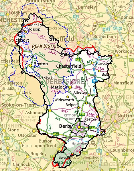
Description: Map of Derbyshire showing modern geographic boundary (black); Watsonian vice-county (red) and Peak District boundary (dotted blue). The vice-county of Derbyshire (VC57) is an unchanging boundary definition, still heavily used for wildlife recording purposes.
Title: Map of Derbyshire boundaries plus Peak District
Credit: Ordnance Survey OpenData Vice-county boundary from National Biodiversity Network administrative boundary data from OS Boundary-Line product. map background from OS OpenData MiniScale vice-county also based on OS maps and can be used within the terms of the OS Open Data Licence see[1]
Author: Parkywiki, created using Ordnance Survey data
Permission: This file is licensed under the Creative Commons Attribution-Share Alike 3.0 Unported license. Attribution: Contains Ordnance Survey data © Crown copyright and database right You are free: to share – to copy, distribute and transmit the work to remix – to adapt the work Under the following conditions: attribution – You must attribute the work in the manner specified by the author or licensor (but not in any way that suggests that they endorse you or your use of the work). share alike – If you alter, transform, or build upon this work, you may distribute the resulting work only under the same or similar license to this one. http://creativecommons.org/licenses/by-sa/3.0 CC BY-SA 3.0 Creative Commons Attribution-Share Alike 3.0 truetrue
Usage Terms: Creative Commons Attribution-Share Alike 3.0
License: CC BY-SA 3.0
License Link: http://creativecommons.org/licenses/by-sa/3.0
Attribution Required?: Yes
Image usage
The following page links to this image:
