
Image: Map of Dunduff castle & roads
Size of this preview: 338 × 599 pixels. Other resolutions: 135 × 240 pixels | 3,152 × 5,584 pixels.
Original image (3,152 × 5,584 pixels, file size: 3.02 MB, MIME type: image/jpeg)
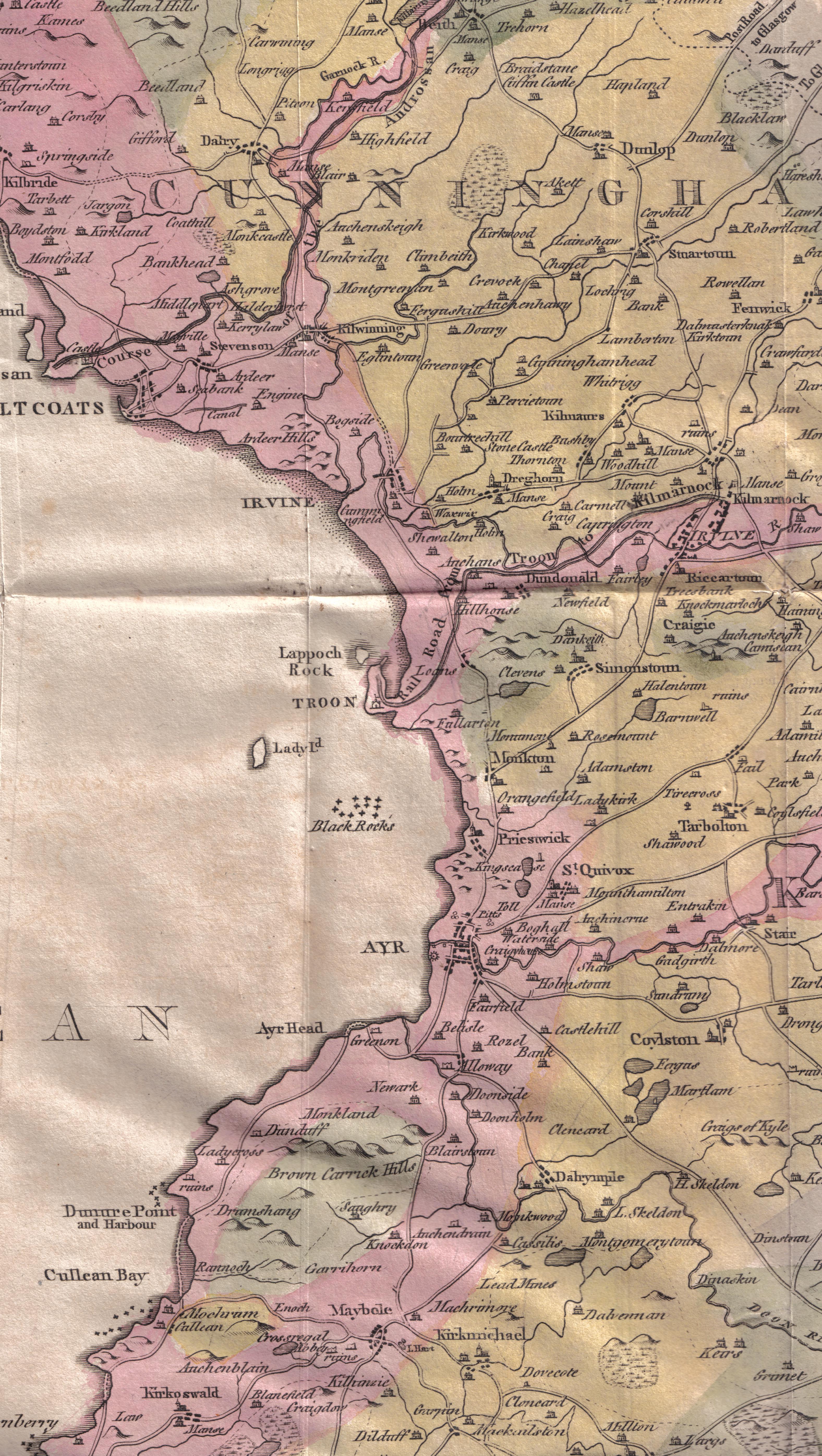
Description: A map of Ayrshire showing Dunduff Castle and the roads and trackways. Scotland.
Title: Map of Dunduff castle & roads
Credit: William Aiton General View of the Agriculture of the County of Ayr
Author: Roger Griffith William Aiton
Usage Terms: Public domain
License: Public domain
Attribution Required?: No
Image usage
The following 19 pages link to this image:
- Auchenharvie Castle
- Barony and Castle of Corsehill
- Barony and Castle of Giffen
- Broadstone Castle
- Busbie Castle
- Castle and Barony of Robertland
- Clonbeith Castle
- Craigie Castle
- Cunninghamhead Estate
- Dunduff Castle
- Dunure Castle
- Eglinton Castle
- Helenton Loch
- Kilmaurs Castle
- Kilmaurs Place
- Loch Fergus
- Monkton, South Ayrshire
- Montgreenan
- Rowallan Castle

All content from Kiddle encyclopedia articles (including the article images and facts) can be freely used under Attribution-ShareAlike license, unless stated otherwise.