
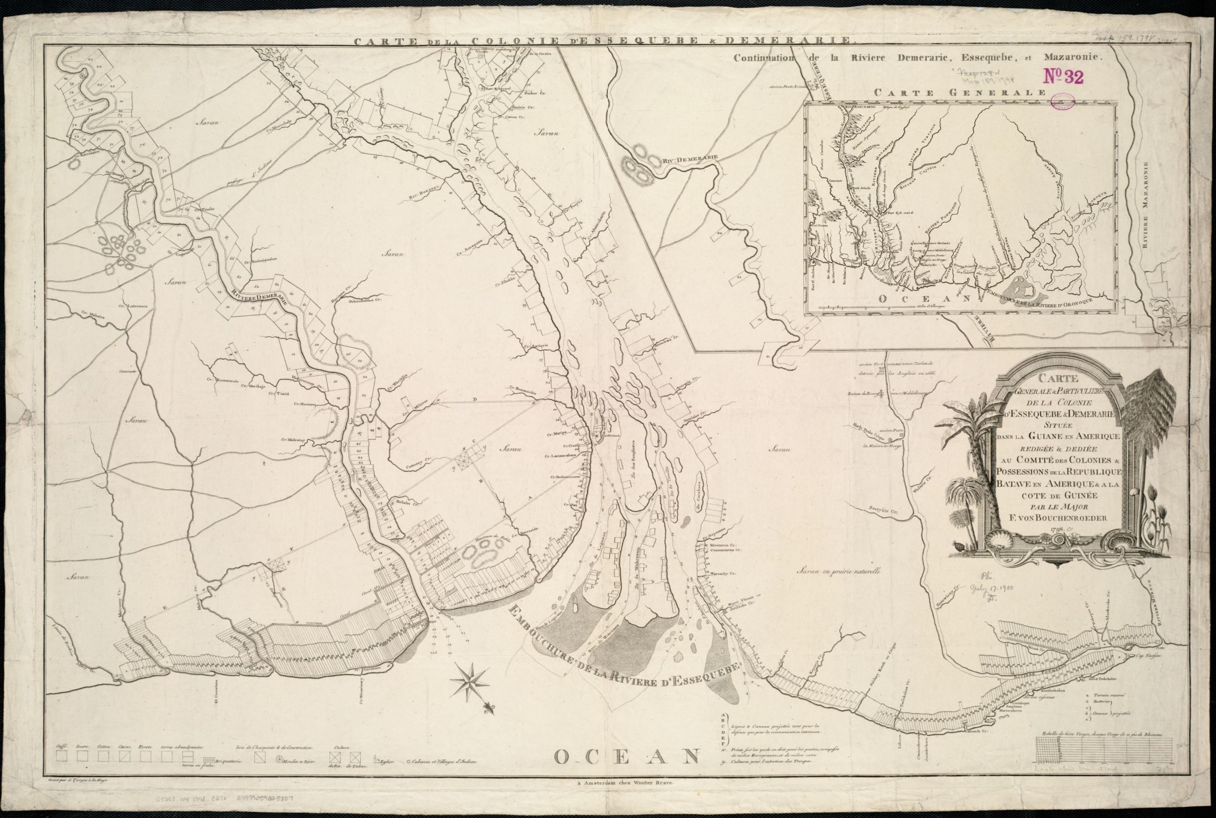
Image: Map of Essequibo and Demerara, 1798
Size of this preview: 800 × 538 pixels. Other resolutions: 320 × 215 pixels | 4,027 × 2,709 pixels.
Original image (4,027 × 2,709 pixels, file size: 1.03 MB, MIME type: image/jpeg)
Description: Zoom into this map at maps.bpl.org. Publisher: Brave, Wouter Date: 1798 Location: Demerara, Essequibo Dimension 62x97cm Scale: ca. 1:190,080 Call Number: G5253.W4 1798 .C37x
Title: Map of Essequibo and Demerara, 1798
Credit: Carte generale et particuliere de la colonie d'Essequebe & Demerarie située dans la Guiane en Amérique Uploaded by Fentener van Vlissingen
Author: http://maps.bpl.org
Usage Terms: Public domain
License: Public domain
Attribution Required?: No
Image usage
The following 2 pages link to this image:

All content from Kiddle encyclopedia articles (including the article images and facts) can be freely used under Attribution-ShareAlike license, unless stated otherwise.