
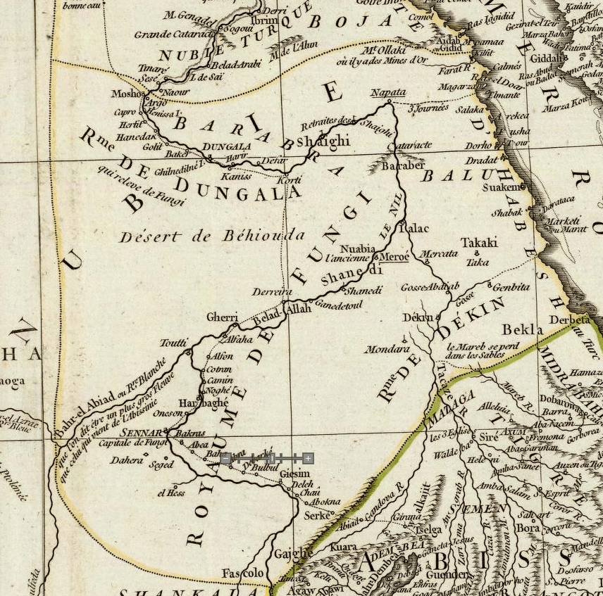
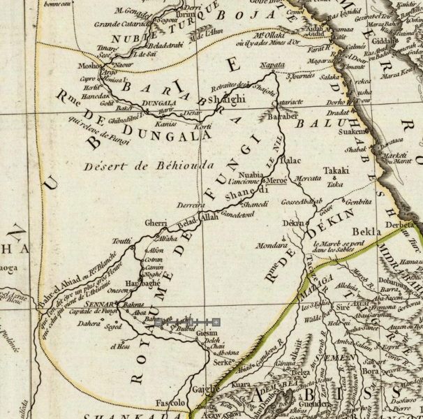
Image: Map of Funj Sultanate (1749)
Size of this preview: 606 × 600 pixels. Other resolutions: 243 × 240 pixels | 856 × 847 pixels.
Original image (856 × 847 pixels, file size: 636 KB, MIME type: image/png)
Description: Map of the Funj Sultanate in 1745 made by J. B. B. d'Anville
Title: Map of Funj Sultanate (1749)
Credit: https://www.davidrumsey.com/luna/servlet/detail/RUMSEY~8~1~4421~410010:-Composite-of--Afrique--Publiee-sou
Author: Jean Baptiste Bourguignon d'Anville
Usage Terms: Public domain
License: Public domain
Attribution Required?: No
Image usage
The following page links to this image:

All content from Kiddle encyclopedia articles (including the article images and facts) can be freely used under Attribution-ShareAlike license, unless stated otherwise.
.png)