
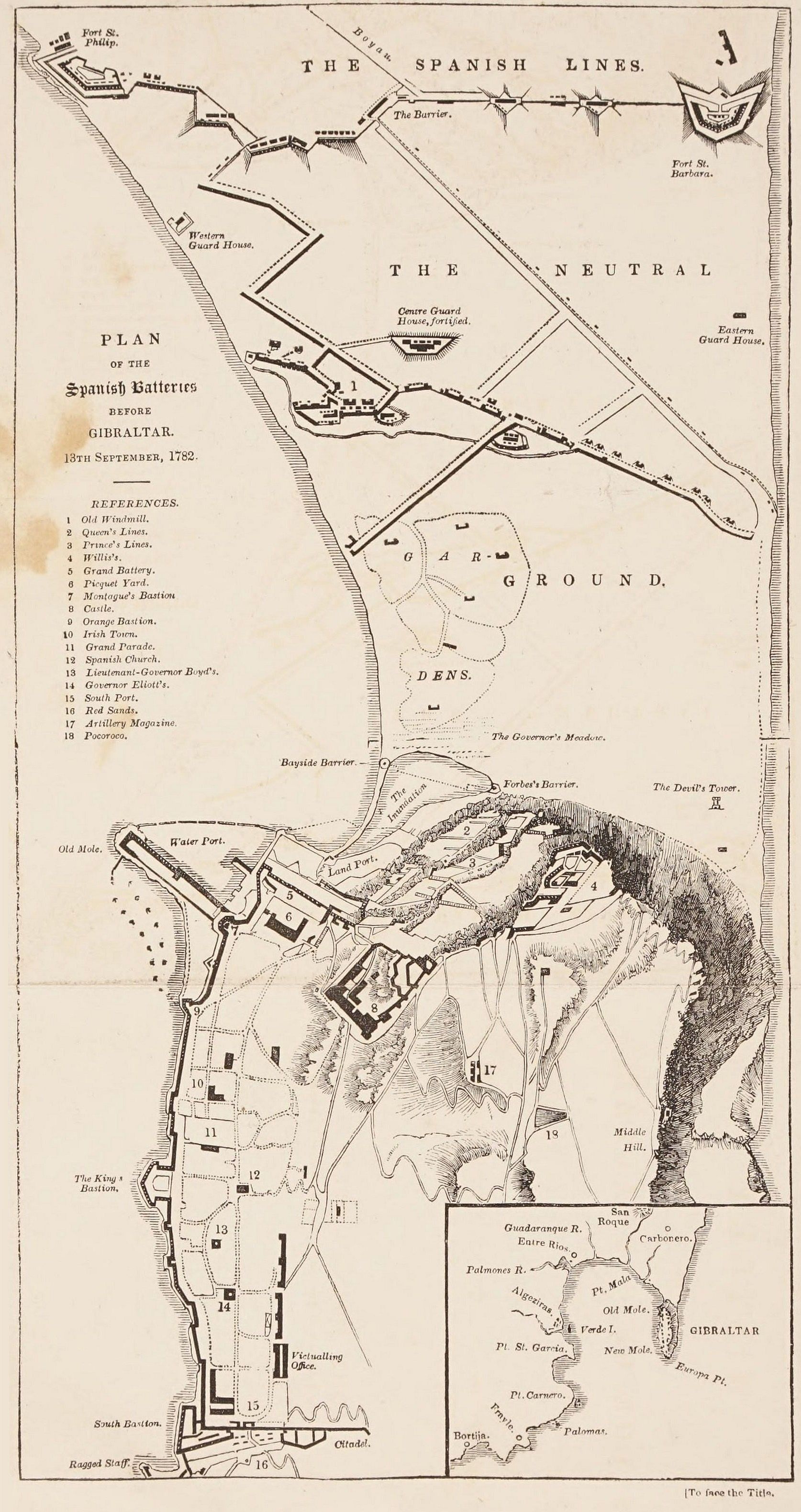
Image: Map of Gibratar, 1782
Size of this preview: 317 × 599 pixels. Other resolutions: 127 × 240 pixels | 1,674 × 3,161 pixels.
Original image (1,674 × 3,161 pixels, file size: 787 KB, MIME type: image/jpeg)
Description: Map of Gibratar, 1782, taken from inside cover of book
Title: Map of Gibratar, 1782
Credit: https://archive.org/details/historyofsiegeof00beth/page/n7/mode/2up
Author: John Drinkwater Bethune
Usage Terms: Public domain
License: Public domain
Attribution Required?: No
Image usage
The following page links to this image:

All content from Kiddle encyclopedia articles (including the article images and facts) can be freely used under Attribution-ShareAlike license, unless stated otherwise.