
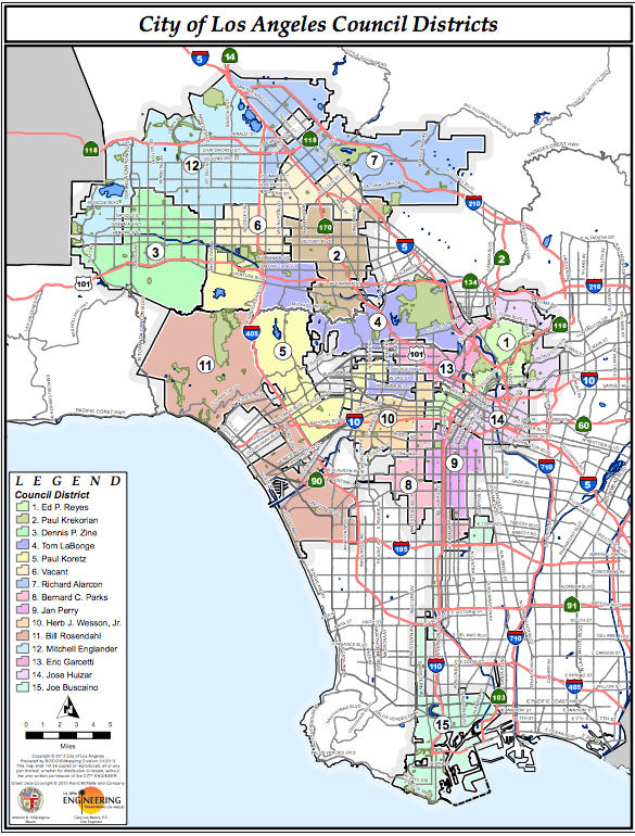
Image: Map of LA City Council Districts
Size of this preview: 455 × 599 pixels. Other resolutions: 182 × 240 pixels | 585 × 770 pixels.
Original image (585 × 770 pixels, file size: 412 KB, MIME type: image/png)
Description: Map of Los Angeles City Council Districts. Boundaries became effective June 1, 2013. Some districts Councilmembers names have changed (2015).
Title: Map of LA City Council Districts
Credit: http://lacity.org/government/AbouttheCityGovernment/index.htm?laCategory=1936
Author: City Council of Los Angeles
Permission: LA City Council
Usage Terms: Public domain
License: Public domain
Attribution Required?: No
Image usage
The following page links to this image:

All content from Kiddle encyclopedia articles (including the article images and facts) can be freely used under Attribution-ShareAlike license, unless stated otherwise.