
Image: Map of London, 1300

Size of this PNG preview of this SVG file: 769 × 600 pixels. Other resolution: 308 × 240 pixels.
Original image (SVG file, nominally 1,080 × 842 pixels, file size: 294 KB)
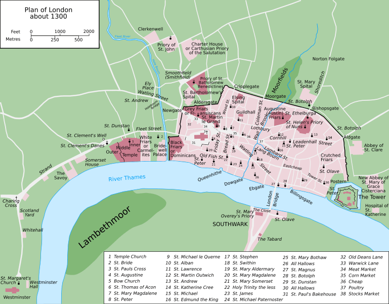
Description: Map of the British city of London in around 1300. Vectorised version of File:Plan of London in 1300.jpg by William R. Shepherd, a work in the public domain in the United States, also its home country, by virtue of being published in 1923 without copyright renewal.
Title: Map of London, 1300
Credit: Own work
Author: Grandiose
Usage Terms: Creative Commons Attribution-Share Alike 3.0
License: CC BY-SA 3.0
License Link: http://creativecommons.org/licenses/by-sa/3.0
Attribution Required?: Yes
Image usage
The following 5 pages link to this image:

All content from Kiddle encyclopedia articles (including the article images and facts) can be freely used under Attribution-ShareAlike license, unless stated otherwise.