
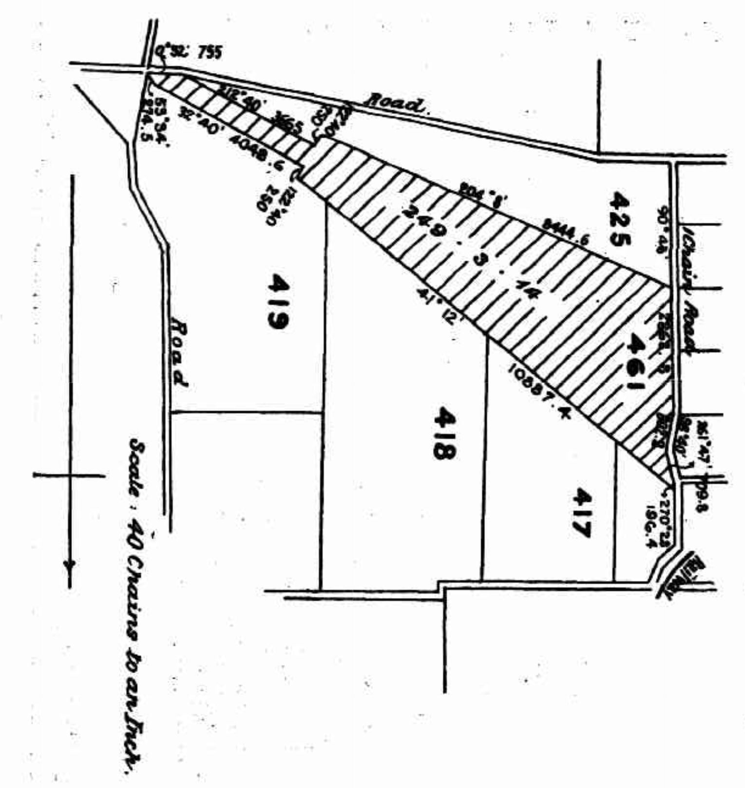
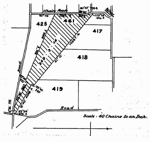
Image: Map of Lowood Rifle Range, 1904
Description: Map of Lowood Rifle Range, 1904. The railway shown in the north-east is the former Brisbane Valley railway line. The roads on the boundaries of the map are unnamed on this map but are Clarendon Road (north), Wyatts Road (west), Rifle Range Road (south west), Forest Hill Fernvale Road (south) and Reinbotts Road (east). Despite what appears to be a compass in the lower part of the map suggesting that north is to the right, the map is in fact oriented so that north is at the top (as normal). The parcel of land of the rifle range (hashed in the map) is Plan CC58 Lot 461.
Title: Map of Lowood Rifle Range, 1904
Credit: (17 December 1904). "ACQUISITION OF A SITE FOR A RIFLE RANGE AT LOWOOD, QUEENSLAND.". Commonwealth Of Australia Gazette (74): 1304. Retrieved on 25 August 2019.
Author: Unknown authorUnknown author
Usage Terms: Public domain
License: Public domain
Attribution Required?: No
Image usage
The following page links to this image:
