
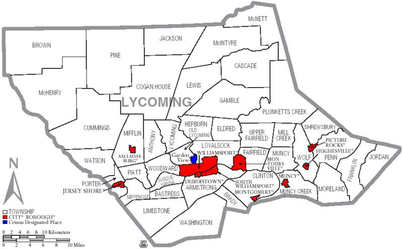
Image: Map of Lycoming County Pennsylvania With Municipal and Township Labels

Size of this preview: 800 × 495 pixels. Other resolutions: 320 × 198 pixels | 882 × 546 pixels.
Original image (882 × 546 pixels, file size: 62 KB, MIME type: image/png)
Description: Map of Lycoming County with township and municipal bondaries is taken from US Census website [1] and modified by User:Ruhrfisch in August 2005. My modifications licensed under the GNU Free Documentation License.
Title: Map of Lycoming County Pennsylvania With Municipal and Township Labels
Credit: US Census website [2]
Author: Ruhrfisch
Usage Terms: Creative Commons Attribution-Share Alike 3.0
License: CC-BY-SA-3.0
License Link: http://creativecommons.org/licenses/by-sa/3.0/
Attribution Required?: Yes
Image usage
The following 3 pages link to this image:

All content from Kiddle encyclopedia articles (including the article images and facts) can be freely used under Attribution-ShareAlike license, unless stated otherwise.