
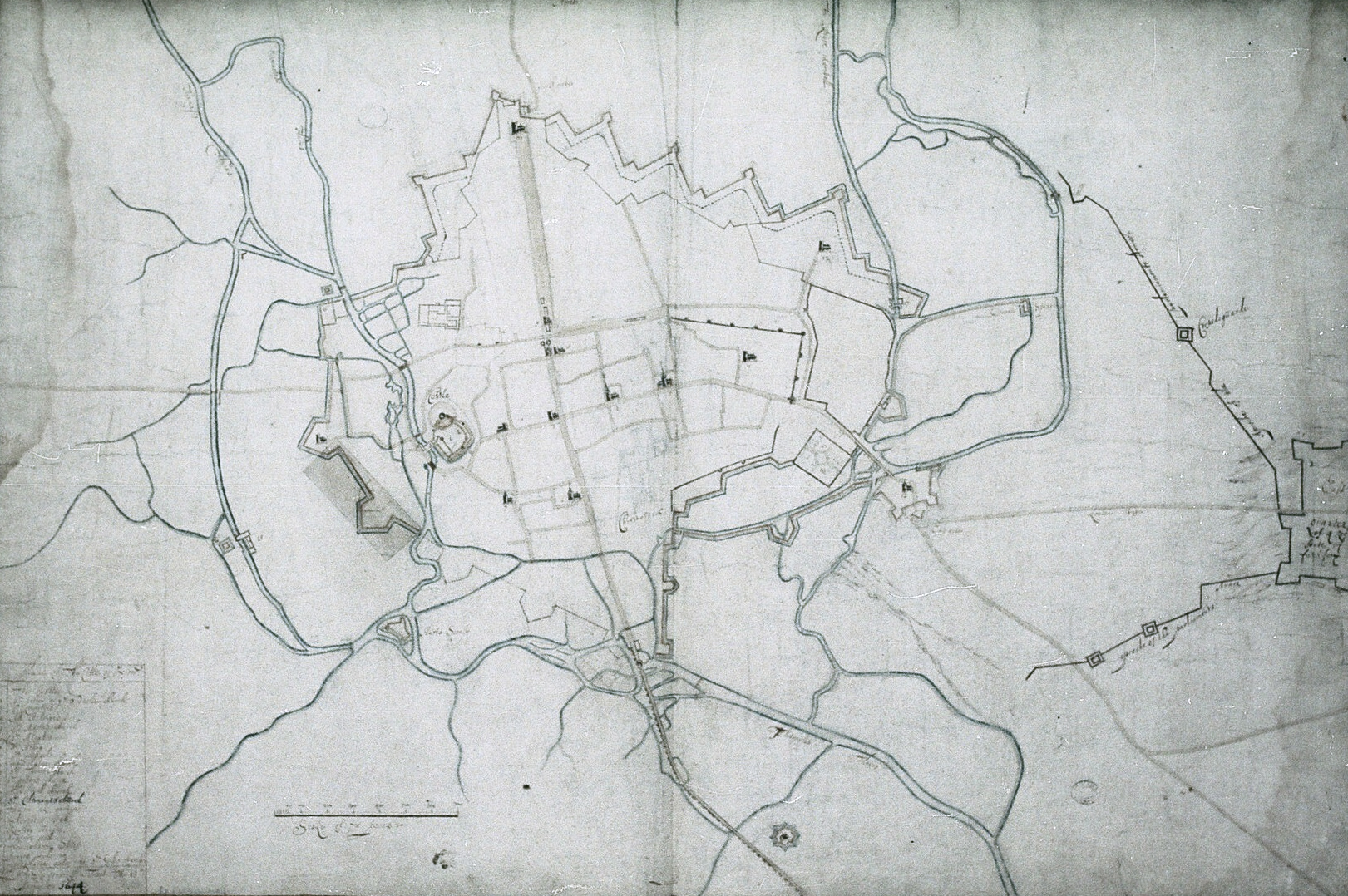
Image: Map of Oxford City fortifications, 1644 by de Gomme
Description: Fortifications were built around the city of Oxford during the English Civil War. Oxford was the Royalist headquarters, home to Charles I and his new Royal parliament. It was therefore a target for the Parliamentarian army, who laid siege in 1644. This map shows the city's defences as well as the Parliamentarian counter-works to the east.
Title: Map of Oxford City fortifications, 1644 by de Gomme
Credit: MS. Top. Oxon b. 167, Filmstrip Roll 221.1, frame 5, via Bodleian Libraries, University of Oxford. https://digital.bodleian.ox.ac.uk/objects/32cafec8-be40-4d9e-b48f-01a24286f768/
Author: Bernard de Gomme, 1620-1685 (Cropping and colour correction by User:JCrue from the original film scan.)
Usage Terms: Public domain
License: Public domain
Attribution Required?: No
Image usage
The following page links to this image:
