
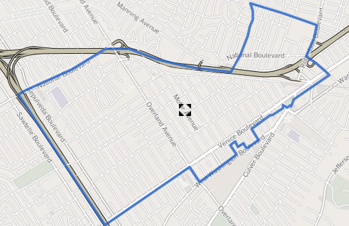
Image: Map of Palms neighborhood, Los Angeles, California
No higher resolution available.
Map_of_Palms_neighborhood,_Los_Angeles,_California.png (696 × 452 pixels, file size: 490 KB, MIME type: image/png)
Description: Map of the boundaries of the Palms neighborhood in Westside Los Angeles, California. As determined by the "Mapping L.A." project of the Los Angeles Times. Will be used at Palms, Los Angeles.
Title: Map of Palms neighborhood, Los Angeles, California
Credit: http://projects.latimes.com/mapping-la/neighborhoods/neighborhood/palms/?q=Palms%2C+Los+Angeles%2C+CA%2C+USA&lat=34.0244133&lng=-118.4075474&g=Geocodify
Author: Los Angeles Times
Permission: http://creativecommons.org/licenses/by-sa/2.0/
Usage Terms: Creative Commons Attribution-Share Alike 3.0
License: CC BY-SA 3.0
License Link: http://creativecommons.org/licenses/by-sa/3.0
Attribution Required?: Yes
Image usage
The following page links to this image:

All content from Kiddle encyclopedia articles (including the article images and facts) can be freely used under Attribution-ShareAlike license, unless stated otherwise.