
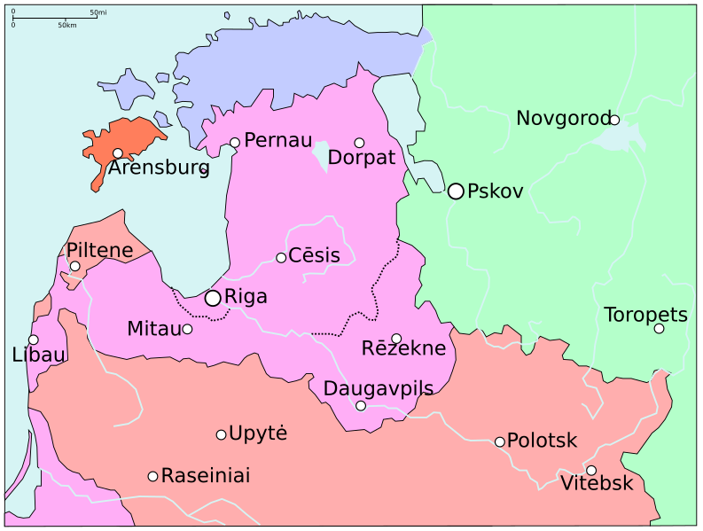
Image: Map of Poland and Lithuania in 1600

Size of this PNG preview of this SVG file: 793 × 600 pixels. Other resolution: 318 × 240 pixels.
Original image (SVG file, nominally 845 × 639 pixels, file size: 48 KB)
Description: Map extract showing the status of Livonia in around 1600, before the Truce of Deulino. Compare with File:Map of Poland and Lithuania after the Union of Lublin (1569).svg. Poland-Lithuania Duchies of Poland-Lithuania Kingdom of Sweden Denmark-Norway Russia
Title: Map of Poland and Lithuania in 1600
Credit: Rzeczpospolita_1600.png
Author: Rzeczpospolita_1600.png: User:Halibutt derivative work: Grandiose (talk)
Usage Terms: Creative Commons Attribution-Share Alike 3.0
License: CC BY-SA 3.0
License Link: http://creativecommons.org/licenses/by-sa/3.0/
Attribution Required?: Yes
Image usage
The following page links to this image:

All content from Kiddle encyclopedia articles (including the article images and facts) can be freely used under Attribution-ShareAlike license, unless stated otherwise.