
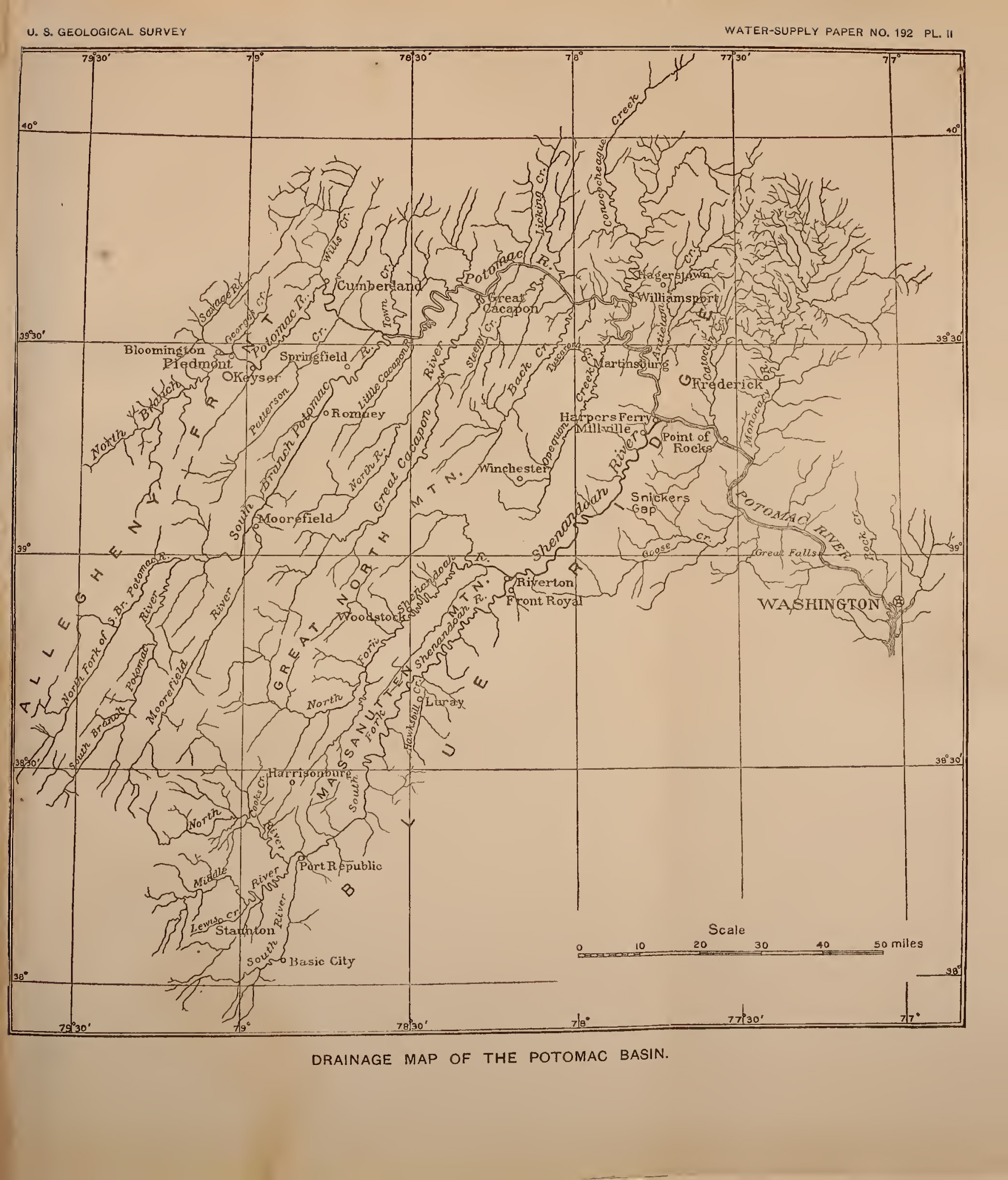
Image: Map of Potomac River Watershed in West Virginia Virginia Pennsylvania Maryland
Size of this preview: 512 × 599 pixels. Other resolutions: 205 × 240 pixels | 2,087 × 2,441 pixels.
Original image (2,087 × 2,441 pixels, file size: 908 KB, MIME type: image/jpeg)
Description: Map of Potomac River Watershed in West Virginia, Virginia, Pennsylvania, and Maryland taken from The Potomac River Basin. Washington, DC: Government Printing Office, 1907.
Title: Map of Potomac River Watershed in West Virginia Virginia Pennsylvania Maryland
Credit: The Potomac River Basin. Washington, DC: Government Printing Office, 1907. https://archive.org/details/potomacriverbasi00park/
Author: U.S. Geological Survey
Usage Terms: Public domain
License: Public domain
Attribution Required?: No
Image usage
The following page links to this image:

All content from Kiddle encyclopedia articles (including the article images and facts) can be freely used under Attribution-ShareAlike license, unless stated otherwise.