
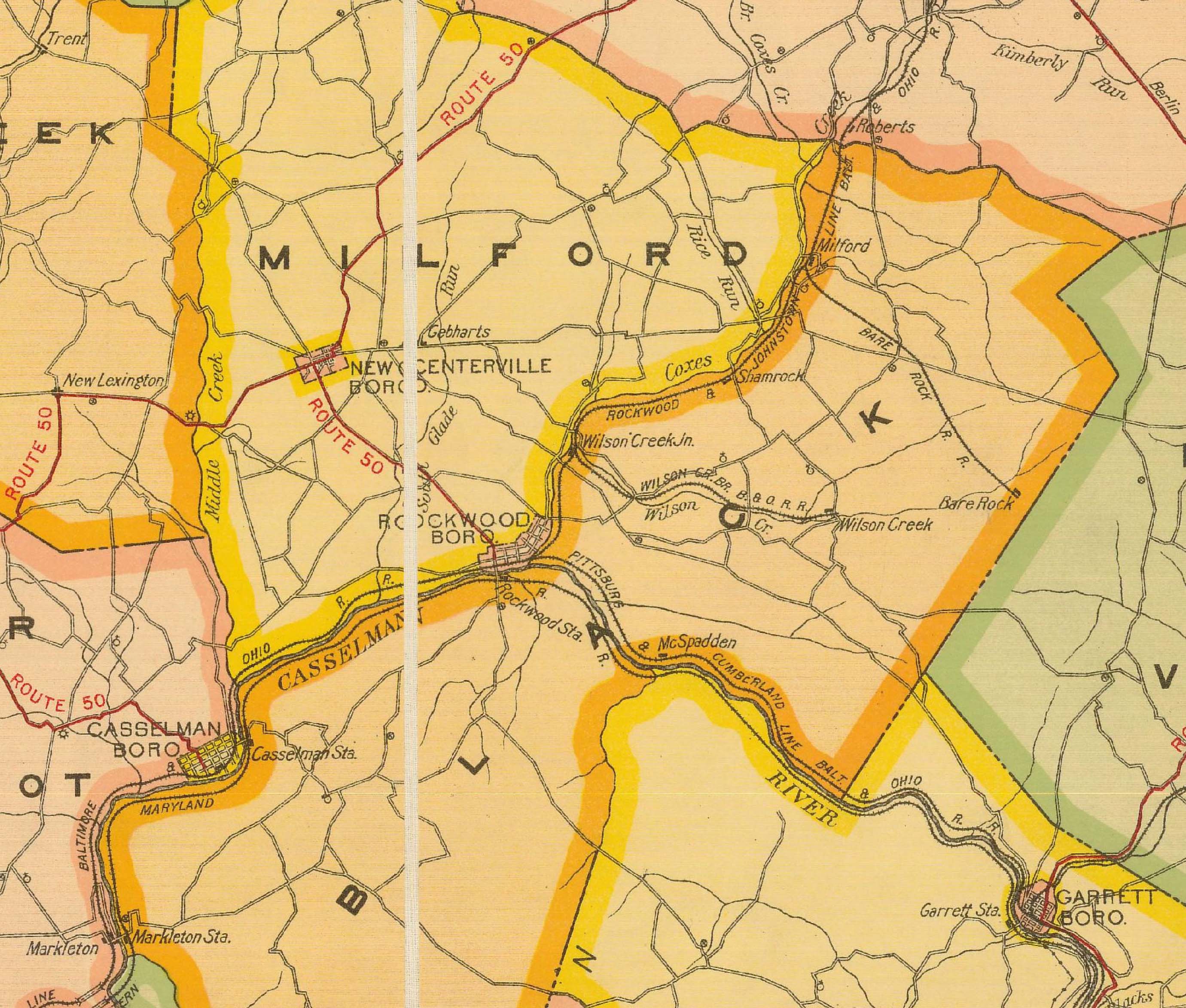
Image: Map of Rockwood, Pennsylvania, area from 1915 Somerset County Public Road Map by Ralph C Benedict and Gustave P Strum
Size of this preview: 706 × 600 pixels. Other resolutions: 283 × 240 pixels | 2,761 × 2,346 pixels.
Original image (2,761 × 2,346 pixels, file size: 760 KB, MIME type: image/jpeg)
Description: Map of Rockwood, Pennsylvania, area taken from 1915 "Map of the Public Roads in Somerset County" by Ralph C. Benedict & Gustave P. Strum available at PennDOT website
Title: Map of Rockwood, Pennsylvania, area from 1915 Somerset County Public Road Map by Ralph C Benedict and Gustave P Strum
Credit: https://gis.penndot.gov/BPR_PDF_FILES/MAPS/Type_10_GHS_Historical_Scans/Somerset_1915.pdf
Author: Ralph C. Benedict & Gustave P. Strum
Usage Terms: Public domain
License: Public domain
Attribution Required?: No
Image usage
The following page links to this image:

All content from Kiddle encyclopedia articles (including the article images and facts) can be freely used under Attribution-ShareAlike license, unless stated otherwise.