
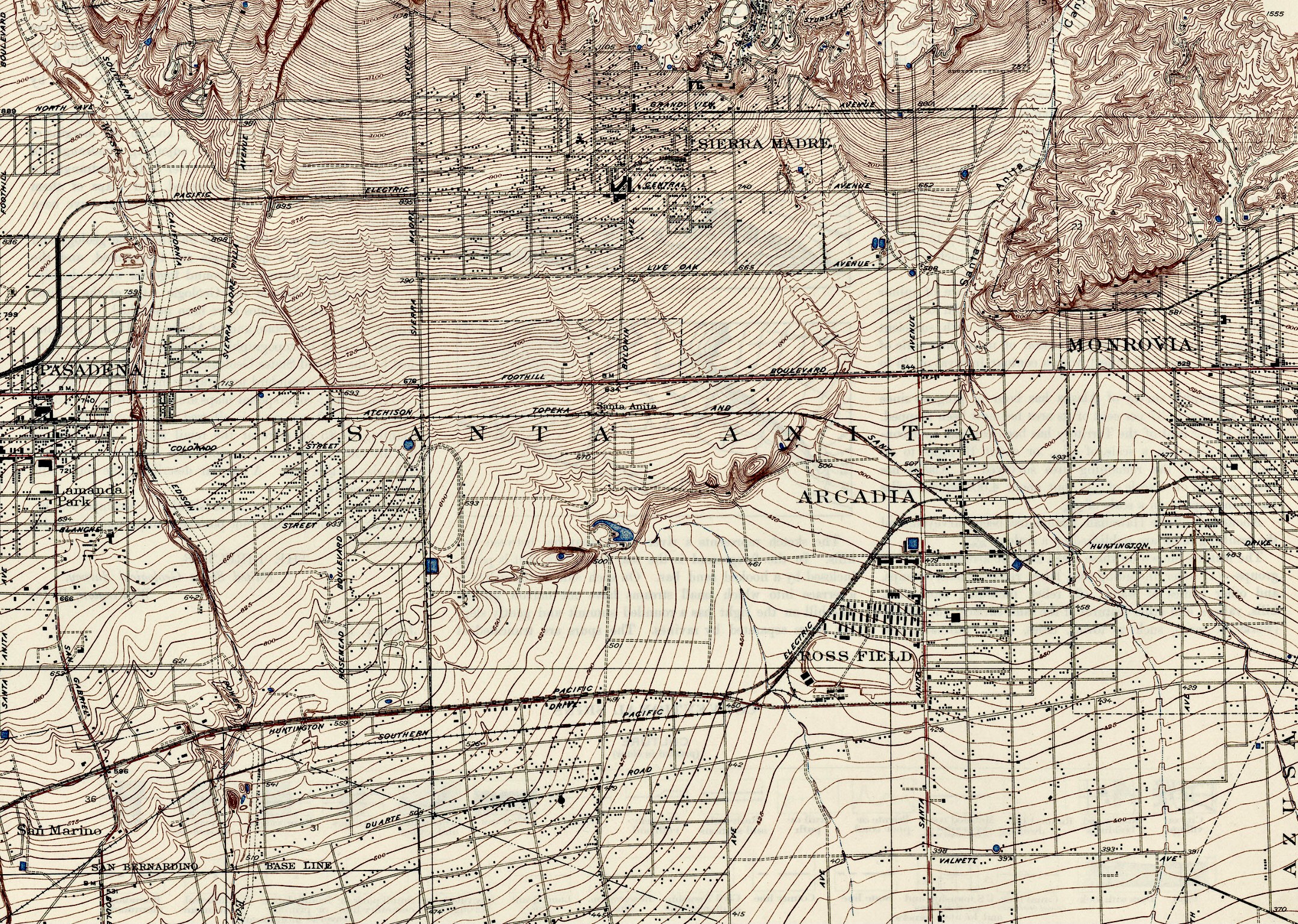
Image: Map of Santa Anita
Size of this preview: 800 × 570 pixels. Other resolutions: 320 × 228 pixels | 2,160 × 1,539 pixels.
Original image (2,160 × 1,539 pixels, file size: 1.79 MB, MIME type: image/jpeg)
Description: Centered on Santa Anita, where Ross Field was, a former Army airfield for balloon aviation. Now Santa Anita racetrack for professional horse racing and betting. Source: USGS, “California (Los Angeles County) Sierra Madre Triangle,” US Department of the Interior (1925).
Title: Map of Santa Anita
Credit: Own work
Author: Ad17minstral
Usage Terms: Creative Commons Attribution-Share Alike 4.0
License: CC BY-SA 4.0
License Link: https://creativecommons.org/licenses/by-sa/4.0
Attribution Required?: Yes
Image usage
The following page links to this image:

All content from Kiddle encyclopedia articles (including the article images and facts) can be freely used under Attribution-ShareAlike license, unless stated otherwise.