
Image: Map of Sendai Earthquake 2011
Size of this preview: 718 × 600 pixels. Other resolutions: 288 × 240 pixels | 897 × 749 pixels.
Original image (897 × 749 pixels, file size: 606 KB, MIME type: image/jpeg)
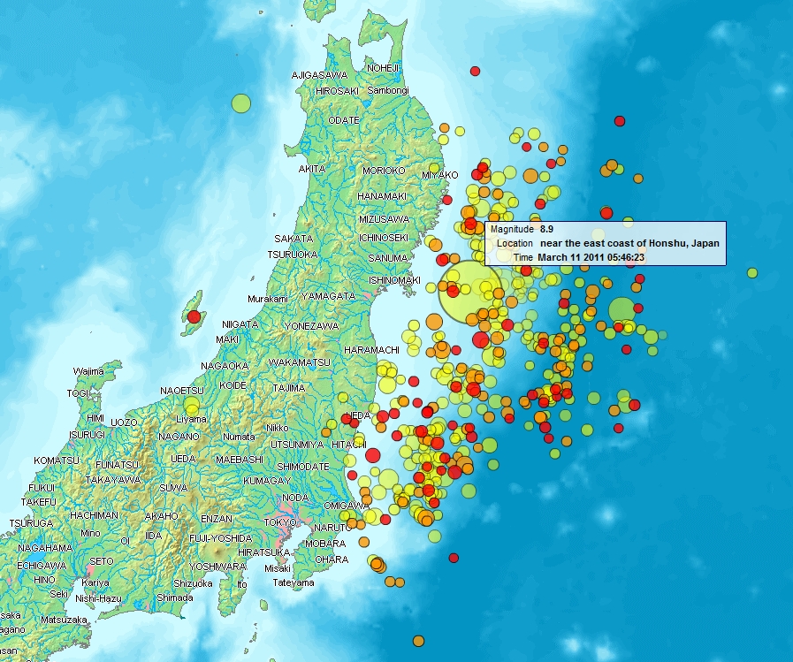
Description: Map of the Sendai Earthquake 2011 and aftershocks until March 14, 2011 at 11:20. The size of the circles is a function of magnitude, and the color indicates the date: light green: March 11; yellow: March 12; orange: March 13; red: March 14.
Title: Map of Sendai Earthquake 2011
Credit: http://www2.demis.nl/quakes/
Author: www2.demis.nl, Uploader User:Heinz-Josef Lücking
Permission: Public domain according to http://www2.demis.nl
Usage Terms: Public domain
License: Public domain
Attribution Required?: No
Image usage
The following page links to this image:

All content from Kiddle encyclopedia articles (including the article images and facts) can be freely used under Attribution-ShareAlike license, unless stated otherwise.