
Image: Map of Tallinn, 1810

Size of this preview: 747 × 600 pixels. Other resolutions: 299 × 240 pixels | 1,748 × 1,403 pixels.
Original image (1,748 × 1,403 pixels, file size: 1.7 MB, MIME type: image/jpeg)
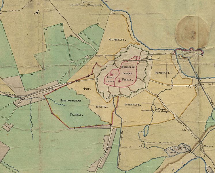
Description: Extract from a 1810 map of Tallinn, showing the borders of Toompea and the rest of town. Toompea (Вышгородъ) on the left, Tallinn (Lower Town - Губернской Городъ Ревелъ) on the right. Border of the territory of Toompea is shown with a red line (Вышгородцкая Граница). Форштатъ: Vorstadt, settlements outside the city walls.
Title: Map of Tallinn, 1810
Credit: Collection of plans and maps of Tallinn City Archives: [1]
Author: Unknown
Usage Terms: Public domain
License: Public domain
Attribution Required?: No
Image usage
The following page links to this image:

All content from Kiddle encyclopedia articles (including the article images and facts) can be freely used under Attribution-ShareAlike license, unless stated otherwise.