
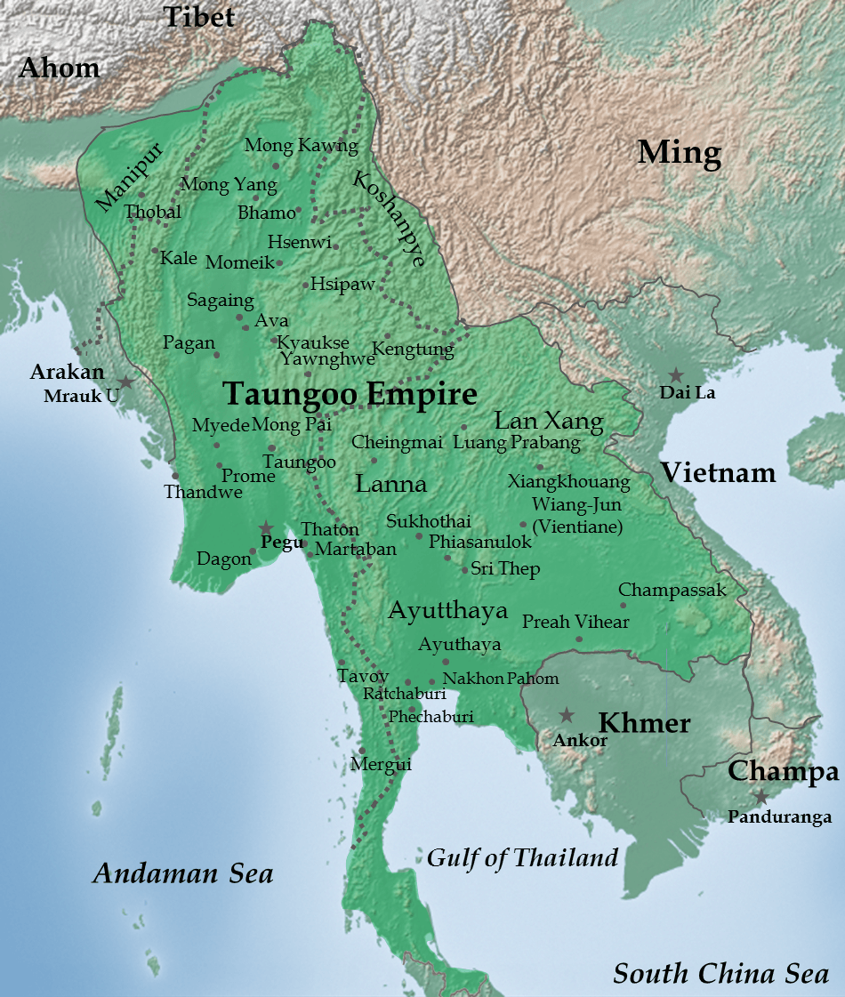
Image: Map of Taungoo Empire (1580)
Size of this preview: 508 × 599 pixels. Other resolutions: 203 × 240 pixels | 950 × 1,121 pixels.
Original image (950 × 1,121 pixels, file size: 1.5 MB, MIME type: image/png)
Description: Taungoo Empire at its highest extent during the reign of King Bayinnaung (1551-1581)
Title: Map of Taungoo Empire (1580)
Credit: Own work. Background map is taken from www.naturalearthdata.com (public domain: Terms of Use).
Author: Soewinhan
Usage Terms: Creative Commons Attribution-Share Alike 3.0
License: CC BY-SA 3.0
License Link: http://creativecommons.org/licenses/by-sa/3.0
Attribution Required?: Yes
Image usage
The following 5 pages link to this image:

All content from Kiddle encyclopedia articles (including the article images and facts) can be freely used under Attribution-ShareAlike license, unless stated otherwise.
.png)