
Image: Map of USA elevations with territories 2

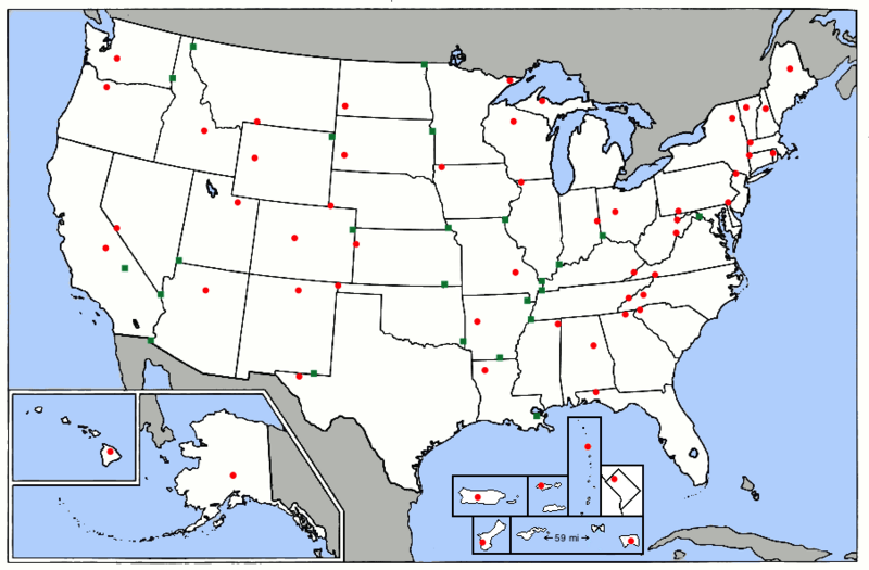
Description: A map of the high points of the U.S. states and territories (red dots) and lowest points (green dots). The 5 major U.S. territories and the District of Columbia are in insets. The U.S. Minor Outlying Islands are not on the map. If the lowest point of a state or territory is an ocean, one of the Great Lakes, or Lake Champlain, there is no green dot. Map is a modified version of the map at this URL: https://commons.wikimedia.org/wiki/File:Map_of_USA_elevations.png
Title: Map of USA elevations with territories 2
Credit: This is a modified version of a map already on Wikimedia Commons at this URL: https://commons.wikimedia.org/wiki/File:Map_of_USA_elevations.png
Author: ChristopherM at English Wikipedia
Usage Terms: Creative Commons Attribution-Share Alike 3.0
License: CC BY-SA 3.0
License Link: https://creativecommons.org/licenses/by-sa/3.0
Attribution Required?: Yes
Image usage
The following 2 pages link to this image:
