
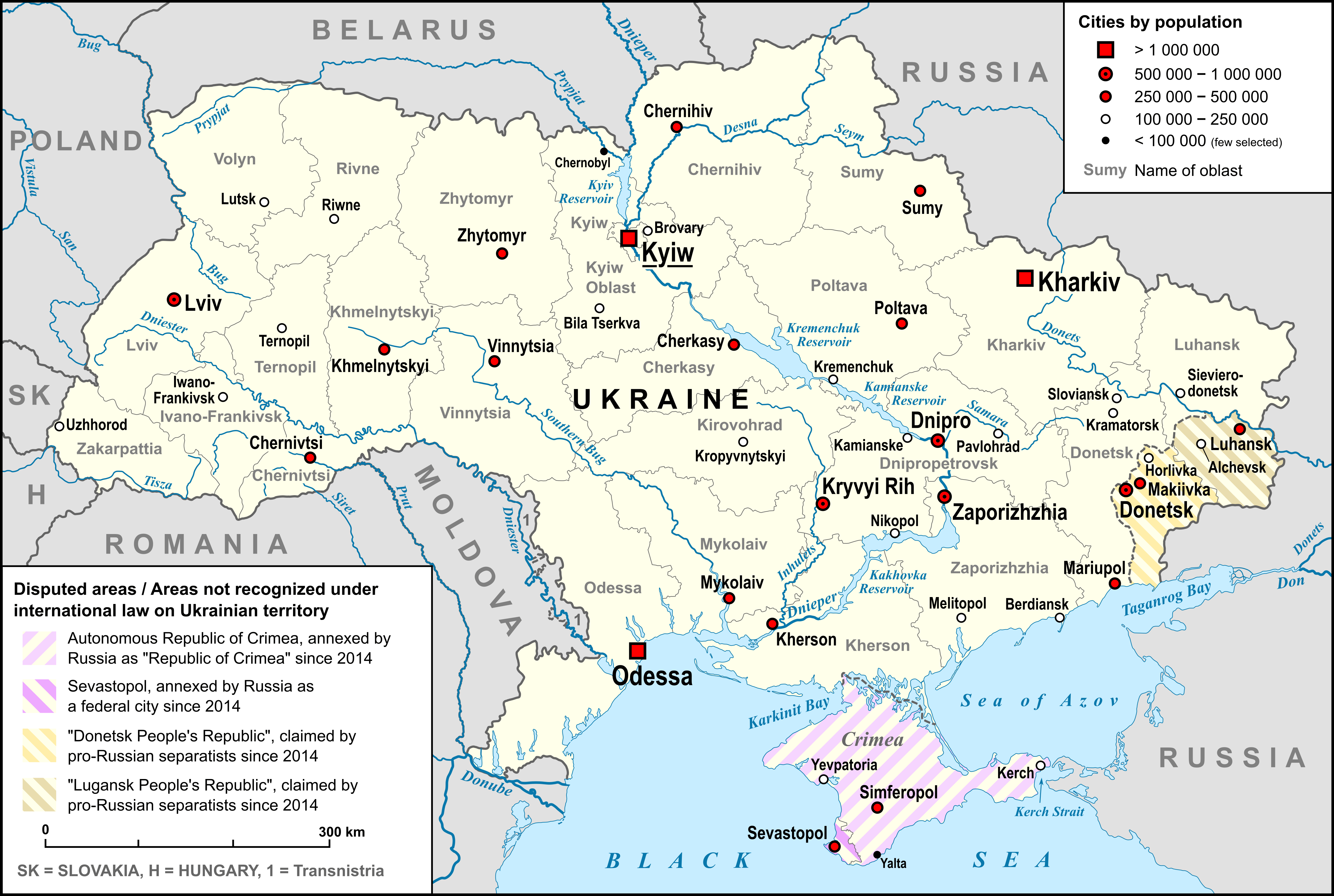
Image: Map of Ukraine with Cities
Size of this preview: 800 × 538 pixels. Other resolutions: 320 × 215 pixels | 4,844 × 3,255 pixels.
Original image (4,844 × 3,255 pixels, file size: 878 KB, MIME type: image/png)
Description: Map of Ukraine, with Oblasts, largest cities, rivers and neighboring countries, as well as the disputed areas on the territory of Ukraine, "Republic of Crimea", "Luhansk People's Republic" and "Donetsk People's Republic"
Title: Map of Ukraine with Cities
Credit: own work, used: Ukraine_adm_location_map.svg by User:NordNordWest Ukraine_2022-02-21.svg by User:NordNordWest Reliefkarte_Ukraine.png by User:Tschubby Liste der Städte in der Ukraine
Author: Lencer
Usage Terms: Creative Commons Attribution-Share Alike 3.0
License: CC BY-SA 3.0
License Link: https://creativecommons.org/licenses/by-sa/3.0
Attribution Required?: Yes
Image usage
The following page links to this image:

All content from Kiddle encyclopedia articles (including the article images and facts) can be freely used under Attribution-ShareAlike license, unless stated otherwise.