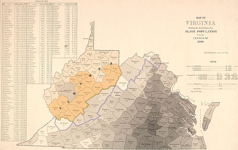
Image: Map of Virginia with percentage of slave population within each county from 1860 Census, from- Proposed state of Kanawha (West Virginia) 1861 as first proposed (cropped)

Size of this preview: 800 × 506 pixels. Other resolutions: 320 × 202 pixels | 10,251 × 6,486 pixels.
Original image (10,251 × 6,486 pixels, file size: 30.71 MB, MIME type: image/jpeg)
Description: The original composition of Kanawha with 39 counties, showing counties (in light orange) that voted in favor of Virginia's secession from the United States on May 23, 1861. The name "Kanawha" was later changed to "West Virginia", which ultimately included 50 counties in its composition in 1863.
Title: Map of Virginia with percentage of slave population within each county from 1860 Census, from- Proposed state of Kanawha (West Virginia) 1861 as first proposed (cropped)
Credit: Own work
Author: Dubyavee
Usage Terms: Creative Commons Attribution-Share Alike 4.0
License: CC BY-SA 4.0
License Link: https://creativecommons.org/licenses/by-sa/4.0
Attribution Required?: Yes
Image usage
The following page links to this image:

All content from Kiddle encyclopedia articles (including the article images and facts) can be freely used under Attribution-ShareAlike license, unless stated otherwise.
