
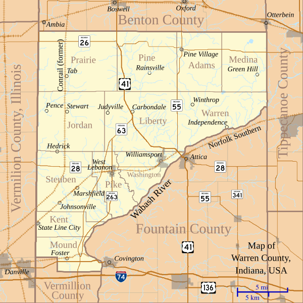
Image: Map of Warren County, Indiana

Size of this PNG preview of this SVG file: 600 × 600 pixels. Other resolution: 240 × 240 pixels.
Original image (SVG file, nominally 768 × 768 pixels, file size: 583 KB)
Description: This is a map of Warren County, Indiana, USA which shows settlements, county and township borders, and major transportation routes.
Title: Map of Warren County, Indiana
Credit: My own work, using custom-written MapScript applications with freely-available United States Census Bureau TIGER data
Author: Omnedon
Usage Terms: Public domain
License: Public domain
Attribution Required?: No
Image usage
The following page links to this image:

All content from Kiddle encyclopedia articles (including the article images and facts) can be freely used under Attribution-ShareAlike license, unless stated otherwise.