
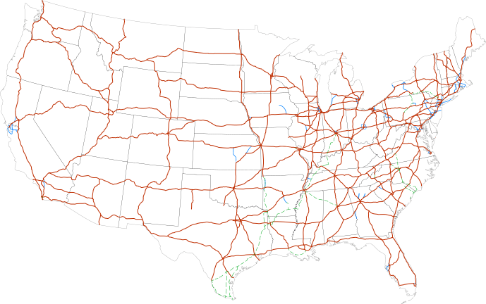
Image: Map of current Interstates

Size of this PNG preview of this SVG file: 689 × 432 pixels. Other resolution: 320 × 201 pixels.
Original image (SVG file, nominally 689 × 432 pixels, file size: 518 KB)
Description: Map of the present Interstate Highway System in the United States
Title: Map of current Interstates
Credit: National Atlas
Author: SPUI
Usage Terms: Public domain
License: Public domain
Attribution Required?: No
Image usage
The following 2 pages link to this image:

All content from Kiddle encyclopedia articles (including the article images and facts) can be freely used under Attribution-ShareAlike license, unless stated otherwise.