
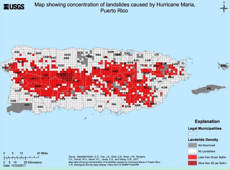
Image: Map of landslides in Puerto Rico - Hurricane Maria 2017
No higher resolution available.
Map_of_landslides_in_Puerto_Rico_-_Hurricane_Maria_2017.jpg (770 × 569 pixels, file size: 141 KB, MIME type: image/jpeg)
Description: map of landslides in Puerto Rico caused by Hurricane Maria 2017
Title: Map of landslides in Puerto Rico - Hurricane Maria 2017
Credit: https://www.usgs.gov/media/images/ls-preliminary-puerto-rico-9
Author: USGS
Usage Terms: Public domain
License: Public domain
Attribution Required?: No
Image usage
The following 5 pages link to this image:

All content from Kiddle encyclopedia articles (including the article images and facts) can be freely used under Attribution-ShareAlike license, unless stated otherwise.