
Image: Map of the Arkansas Delta

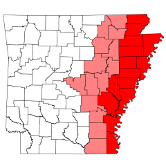
Description: This is a locator map showing the w:Arkansas Delta in Arkansas. The Arkansas Delta is not a well-defined region, so this map shows universally-accepted delta counties in solid red, and counties sometimes reffered to as delta counties or partial delta counties in lighter red. User:Brandonrush created this image, using the original from David Benbennick. For more information, see Commons:United States county locator maps.
Title: Map of the Arkansas Delta
Credit: Map_of_Arkansas_highlighting_Washington_County.svg
Author: Map_of_Arkansas_highlighting_Washington_County.svg: User:Dbenbenn derivative work: Brandonrush (talk)
Usage Terms: Public domain
License: Public domain
Attribution Required?: No
Image usage
The following page links to this image:
