
Image: Map of the Armenian highland and Caucasus mountains 12 122846
Size of this preview: 757 × 599 pixels. Other resolutions: 303 × 240 pixels | 2,400 × 1,900 pixels.
Original image (2,400 × 1,900 pixels, file size: 1.94 MB, MIME type: image/jpeg)
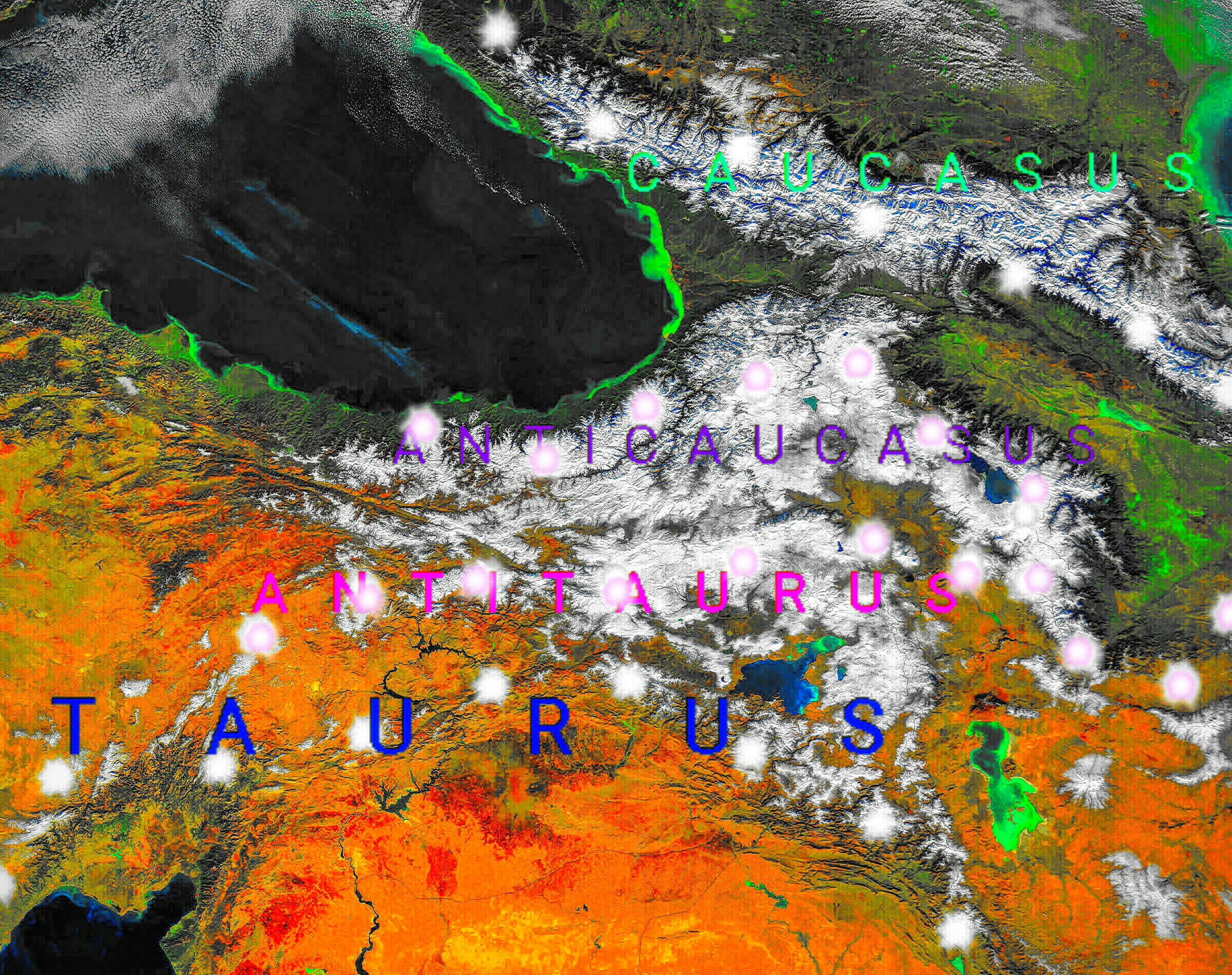
Description: NASA's space satellite photo image of the Armenian highland and Caucasus mountains, which turned into map with descriptions of the geographical areas of this region.
Title: Map of the Armenian highland and Caucasus mountains 12 122846
Credit: Own work using: File:Monts du Caucase.jpg
Author: Казбек Эльбрусович
Usage Terms: Public domain
License: Public domain
Attribution Required?: No
Image usage
The following page links to this image:

All content from Kiddle encyclopedia articles (including the article images and facts) can be freely used under Attribution-ShareAlike license, unless stated otherwise.