
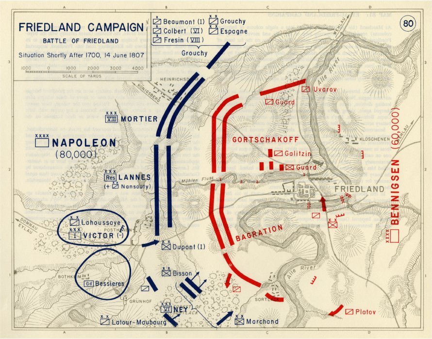
Image: Map of the Battle of Friedland - Situation shortly after 1700, 14 June 1807
Size of this preview: 765 × 600 pixels. Other resolutions: 306 × 240 pixels | 890 × 698 pixels.
Original image (890 × 698 pixels, file size: 185 KB, MIME type: image/jpeg)
Description: Map of the Battle of Friedland - Situation shortly after 1700, 14 June 1807.
Title: Map of the Battle of Friedland - Situation shortly after 1700, 14 June 1807
Credit: [1]
Author: United States Military Academy, West Point
Permission: This image is a work of a U.S. military or Department of Defense employee, taken or made as part of that person's official duties. As a work of the U.S. federal government, the image is in the public domain in the United States.
Usage Terms: Public domain
License: Public domain
Attribution Required?: No
Image usage
The following page links to this image:

All content from Kiddle encyclopedia articles (including the article images and facts) can be freely used under Attribution-ShareAlike license, unless stated otherwise.