
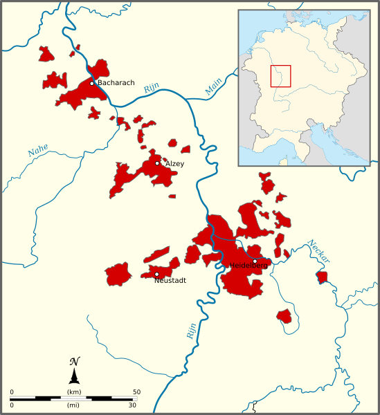
Image: Map of the Electoral Palatinate (1329)

Size of this PNG preview of this SVG file: 549 × 600 pixels. Other resolution: 220 × 240 pixels.
Original image (SVG file, nominally 865 × 945 pixels, file size: 260 KB)
Description: Map of the Electorate of the Palatinate in 1329. The upper-Palatinate is not displayed.
Title: Map of the Electoral Palatinate (1329)
Credit: Own work, based on a map in Kleine Geschichte der Kurpfalz by A.Kohnle
Author: Sir Iain
Usage Terms: Creative Commons Attribution-Share Alike 3.0
License: CC BY-SA 3.0
License Link: https://creativecommons.org/licenses/by-sa/3.0
Attribution Required?: Yes
Image usage
The following page links to this image:

All content from Kiddle encyclopedia articles (including the article images and facts) can be freely used under Attribution-ShareAlike license, unless stated otherwise.
.svg)