
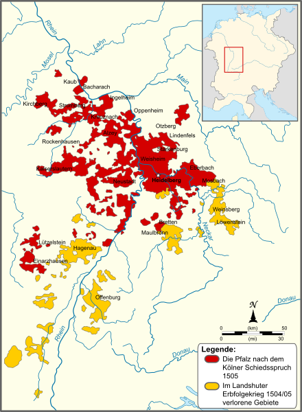
Image: Map of the Electoral Palatinate (1505)-DE

Size of this PNG preview of this SVG file: 440 × 600 pixels. Other resolution: 176 × 240 pixels.
Original image (SVG file, nominally 855 × 1,165 pixels, file size: 422 KB)
Description: Map of the Electorate of the Palatinate in 1505. Areas lost in the War of Succession of Landshut are marked yellow. The Upper-Palatinate is not depicted.
Title: Map of the Electoral Palatinate (1505)-DE
Credit: This file was derived from: Map of the Electoral Palatinate (1505)-NL.svg:
Author: Map_of_the_Electoral_Palatinate_(1505)-NL.svg: Sir Iain derivative work: Furfur (talk)
Usage Terms: Creative Commons Attribution-Share Alike 3.0
License: CC BY-SA 3.0
License Link: https://creativecommons.org/licenses/by-sa/3.0
Attribution Required?: Yes
Image usage
The following page links to this image:

All content from Kiddle encyclopedia articles (including the article images and facts) can be freely used under Attribution-ShareAlike license, unless stated otherwise.
-DE.svg)