
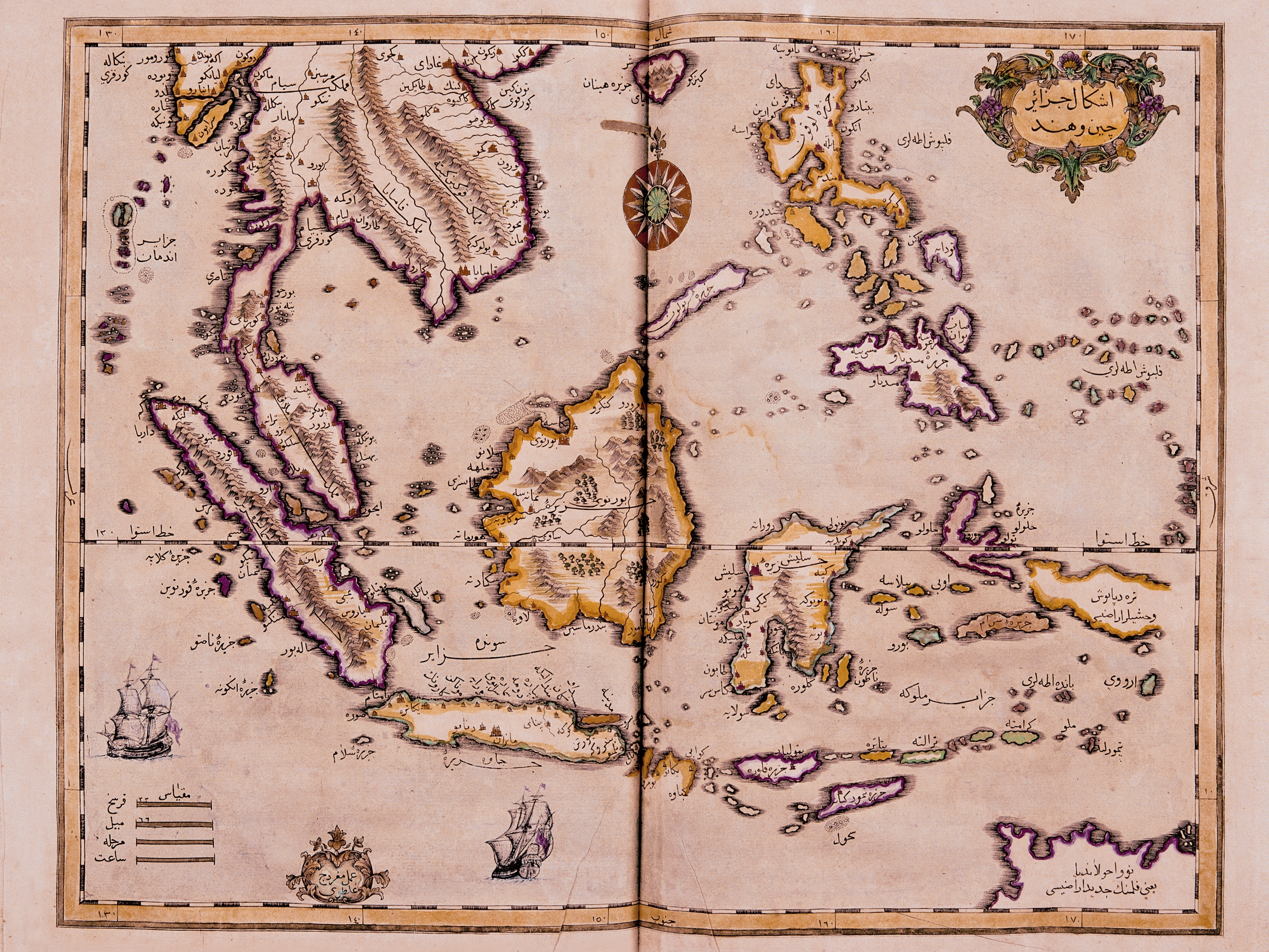
Image: Map of the Indian Ocean and the China Sea was engraved in 1728 by Ibrahim Müteferrika
Size of this preview: 800 × 600 pixels. Other resolutions: 320 × 240 pixels | 2,552 × 1,914 pixels.
Original image (2,552 × 1,914 pixels, file size: 5.24 MB, MIME type: image/jpeg)
Description: This map of the Indian Ocean and the China Sea was engraved in 1728 by the Hungarian-born Ottoman cartographer and publisher Ibrahim Müteferrika; it is one of a series that illustrated Kâtib Çelebi’s Cihannuma (Universal Geography), the first printed book of maps and drawings to appear in the Islamic world. CAMBRIDGE UNIVERSITY LIBRARY
Title: Map of the Indian Ocean and the China Sea was engraved in 1728 by Ibrahim Müteferrika
Credit: it is one of a series that illustrated Kâtib Çelebi’s Cihannuma (Universal Geography) http://cimes.csusb.edu/newsEvents/map5.htm
Author: Ibrahim Müteferrika
Usage Terms: Public domain
License: Public domain
Attribution Required?: No
Image usage
The following page links to this image:

All content from Kiddle encyclopedia articles (including the article images and facts) can be freely used under Attribution-ShareAlike license, unless stated otherwise.