
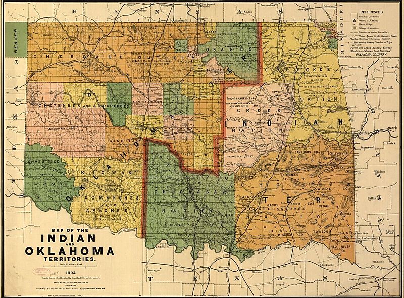
Image: Map of the Indian and Oklahoma Territories 1892

Size of this preview: 800 × 590 pixels. Other resolutions: 320 × 236 pixels | 1,221 × 900 pixels.
Original image (1,221 × 900 pixels, file size: 368 KB, MIME type: image/jpeg)
Description: This map was published in 1892 by the Rand McNally Co. in Chicago. It shows the borders of Native American located in Oklahoma.
Title: Map of the Indian and Oklahoma Territories 1892
Credit: https://www.loc.gov/item/98687110/
Author: Rand McNally and Company
Usage Terms: Public domain
License: Public domain
Attribution Required?: No
Image usage
The following 2 pages link to this image:

All content from Kiddle encyclopedia articles (including the article images and facts) can be freely used under Attribution-ShareAlike license, unless stated otherwise.