
Image: Map of the Original City of Philadelphia in 1682 by Thomas Holme
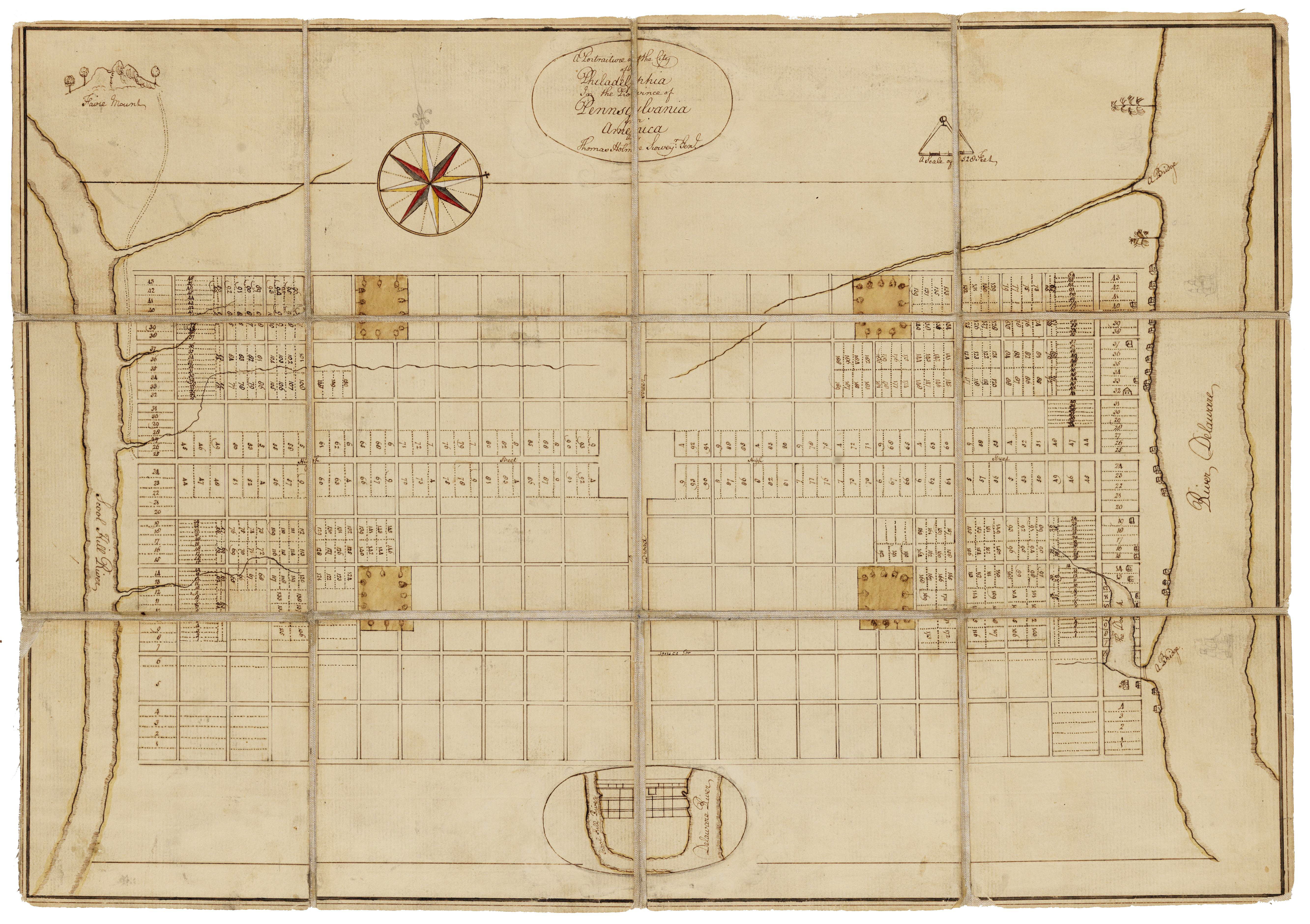
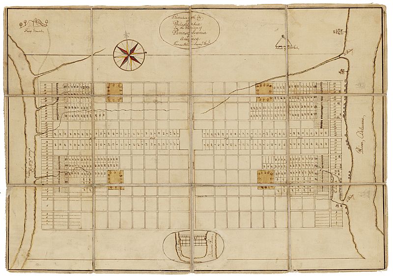
Description: Holme, Thomas (1683). A Portraiture of the City of Philadelphia (map): In the province of Pennsylvania in America. London: Sold by Andrew Sowle in Shoreditch. In 1682, William Penn appointed Holme surveyor-general of Pennsylvania and charged him with the task of laying out the "greene country towne" that Penn envisioned along the Delaware River. The site that Penn acquired for the city of Philadelphia stretched two miles east to west across a tract of land situated between the Delaware and Schuylkill Rivers; all told, the rectangular grid of land comprised twelve thousand acres. Holme imposed an orderly grid plan on the site, with streets organized around a large square in the center of the town and four smaller squares, one in each quadrant. The grid also included two main streets, Broad and High (present-day Market), which were kept wide in hopes of preventing the kind of fire that destroyed London in 1666. Completed in 1683, this map was used for both reference and promotional purposes to show the unique layout of William's Penn emerging city. From the Historical Society of Pennsylvania: https://hsp.org/education/primary-sources/a-map-of-the-original-city-of-philadelphia
Title: Map of the Original City of Philadelphia in 1682 by Thomas Holme
Credit: https://hsp.org/education/primary-sources/a-map-of-the-original-city-of-philadelphia
Author: Thomas Holme
Usage Terms: Public domain
License: Public domain
Attribution Required?: No
Image usage
The following 4 pages link to this image:
