
Image: Map of the Sandpoint Idaho Region
No higher resolution available.
Map_of_the_Sandpoint_Idaho_Region.png (707 × 571 pixels, file size: 64 KB, MIME type: image/png)
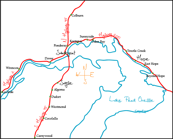
Description: Image description: A rough sketch of the layout of the highways and cities surrounding Northern Lake Pend Oreille in Northern Idaho. Who took/created the image: This image was created by me, Wikivoyage User L'Aquatique. When the image was taken/created: 27 July 2007 For a vector format, check out Image:Map of the Sandpoint Idaho Region.svg (WT-shared) L'Aquatique 00:55, 28 July 2007 (EDT) map: Idaho Map of: Idaho
Title: Map of the Sandpoint Idaho Region
Author: User: (WT-shared) L'Aquatique at wts wikivoyage
Usage Terms: Creative Commons Attribution-Share Alike 2.5
License: CC BY-SA 2.5
License Link: http://creativecommons.org/licenses/by-sa/2.5
Attribution Required?: Yes
Image usage
The following page links to this image:

All content from Kiddle encyclopedia articles (including the article images and facts) can be freely used under Attribution-ShareAlike license, unless stated otherwise.