
Image: Map prevailing winds on earth

Size of this preview: 800 × 351 pixels. Other resolutions: 320 × 140 pixels | 1,425 × 625 pixels.
Original image (1,425 × 625 pixels, file size: 157 KB, MIME type: image/png)
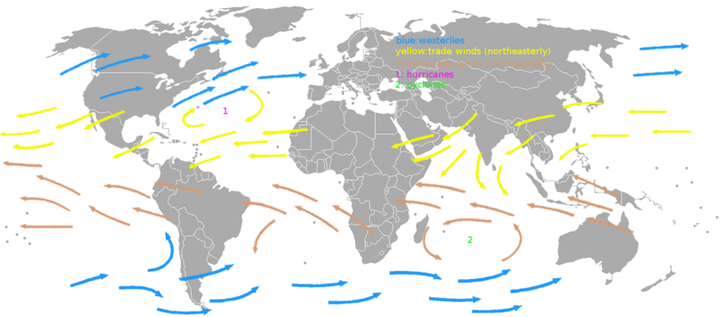
Description: A map showing the prevaling winds on earth. The image was made based on an image in the book "Het handboek voor de zeiler" by H.C. Herreshoff.
Title: Map prevailing winds on earth
Credit: Own work
Author: KVDP
Usage Terms: Public domain
License: Public domain
Attribution Required?: No
Image usage
The following page links to this image:

All content from Kiddle encyclopedia articles (including the article images and facts) can be freely used under Attribution-ShareAlike license, unless stated otherwise.