
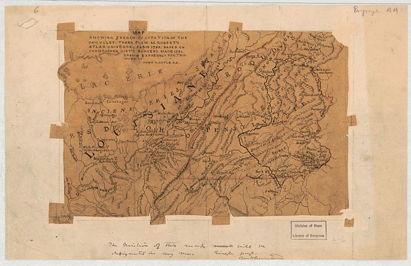
Image: Map showing French occupation of the Ohio Valley - taken from Mr. Robert's Atlas universel, Paris 1755 - based on Christopher Gist's surveys made 1751 LOC 2018590090

Description: Relief shown by hachures. Show parts of Ohio and Pennsylvania adjacent to Lake Erie. Manuscript map: pen-and-ink and watercolor, mounted on cloth backed paper. Printed map mounted on cloth, annotated in blue crayon and pencil. Map prepared for the Illustrated history of Washington County. Available also through the Library of Congress Web site as a raster image.
Title: Map showing French occupation of the Ohio Valley - taken from Mr. Robert's Atlas universel, Paris 1755 - based on Christopher Gist's surveys made 1751 LOC 2018590090
Credit: https://www.loc.gov/item/2018590090/
Author: Ruple, John G.
Permission: This map is available from the United States Library of Congress's Geography & Map Division under the digital ID g4081s.ct008326. This tag does not indicate the copyright status of the attached work. A normal copyright tag is still required. See Commons:Licensing for more information.
Usage Terms: Public domain
License: Public domain
Attribution Required?: No
Image usage
The following 3 pages link to this image:
